


Swamp Thing Trail
ESTONIA
HIGH POINT
104 m
DIFFICULTY (1/10)
7
DISTANCE
386 Km
DAYS
5
% SINGLETRACK
20%
% UNPAVED
95%
TOTAL ASCENT
1592 m
% RIDEABLE TIME
99%
Deep in the northeast of Europe, there’s a wild, untamed trail that winds through floodplain taiga, quicksand, swamps, meadows, and bogs, all while crossing the migratory path of Arctic waterfowl. This is a land of countless rivers and lakes that eventually spill into the remote, breathtaking shores of the Baltic Sea. Welcome to the wild heart of Estonia.
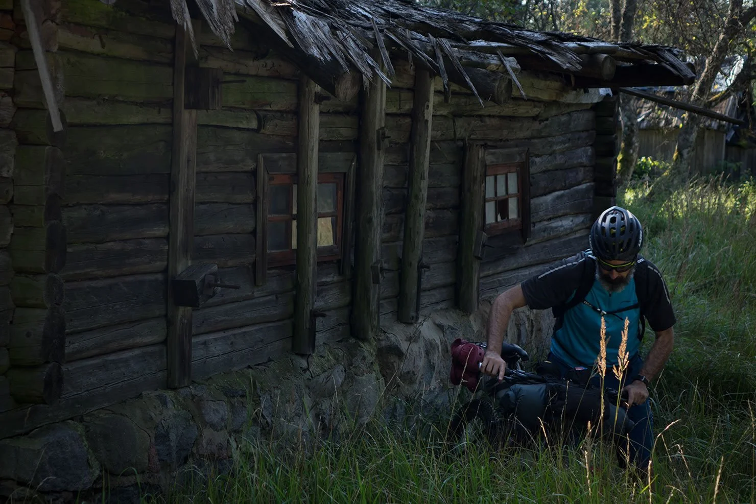
The Swamp Thing Trail is a 386km route running south to north through one of the most densely forested countries in the world. Its name comes from Swamp Thing, a 1970s comic book about a swamp monster—an earthy, plant-like guardian that fights to protect his home and the environment. It’s a fitting name, not just because of the eerie, otherworldly landscapes you’ll ride through, but also because of Estonia’s deep commitment to conservation. After regaining independence in the 1990s, the country made preserving its wilderness a priority. The adventure kicks off in Pärnu, a small coastal city on Estonia’s west side. From there, the trail plunges into a towering coniferous forest, where an old rusted railway bridge welcomes you into Laiksaare forest. As you push forward, empty gravel roads and winding singletrack pull you deeper into the Estonian backcountry, through thick carpets of moss, wild berries, and mushrooms. The boglands are straight out of a dream—vast, eerie, and stunning—where mist drifts across the lowlands at dawn and dusk. For the best view, climb one of the observation towers and take it all in.
Technically, the trail isn’t too challenging—there’s minimal elevation gain, and the singletrack is manageable. But don’t be fooled: this is still an intense ride. The relentless mosquitoes alone make it worthy of a 7/10 difficulty rating, not to mention the struggle to find drinking water. Water resupply points are scarce, and most of the rivers and streams have a murky, brownish-orange tint—meaning purification is a must. Another wildcard? Flooding. Depending on the conditions, you might find yourself wading through waist-deep water or having to reroute altogether. After cutting through Soomaa National Park and the Kõrvemaa Landscape Reserve, the final stretch leads through Lahemaa National Park to one of the most breathtaking spots on the entire route: Mädalaht Bay on the Käsmu Peninsula. Picture massive boulder fields, soft sandy beaches, and towering conifers right on the edge of the Baltic. Out on the horizon? Devil’s Island, adding to the mystique. If you’re brave enough, take a dip in the icy waters—an unforgettable way to end an epic ride.


-
Surju Train Station was built in 1896 under the Tsar Nicholas II, the last Emperor of Russia. It’s an estonian cultural monument.
Farm Museum of C. R. Jakobson at Kurgja and The flour and saw watermill, built in 1879, at the Pärnu River worth a visit.
Soomaa Nature Center in the Soomaa National Park. Here you can have information materials and watch films about the Park. You can also explore the flora of Central Estonia, the cultural history, and experience the fifth season of Soomaa – the flood.
In the Centre it’s possible to see the exhibition of the epic “Fifth Season” of 2010.
Estonian forests are populated by european lynx, brown bears, wolves, moose, beavers and flying squirrels that can only be seen in Estonia and Sweden. You can also meet a lot of galliformes as the Hazel Grouse, the Capercaillie and the Grouse. Flocks of white storks will often accompany your trip.
Observation tower near Lake Paukjärve. A sort of time machine on which it’s worth going to watch the primitive bog landscapes.
Swimming in the Baltic Sea. The Mädalaht bay, at the end of the trail, is the best place to do this, and have chilling time and a beer!
-
The best time to tackle this route is from June to August, with temperatures ranging from 10° C to 20° C. July and August, however, are the wettest months.
Pärnu, the trail starting point, is easily reaching by train from Tallinn and bikes may be transported without additional cost.
Don’t forget anti-mosquito net hat and a ton of repellent.
If anybody should give you a Vodka, drink it in one shot without coughing!
The trail is mainly made up of empty gravel roads and singletracks, never really technical except in brief steps.
The floods can inundate large areas, and you may find yourself facing deep fords without the possibility of bypass them. Crocs might come in handy.
-
Along the trail we counted 9 campsites and 18 campfires, equipped with outdoor fireplaces, fire rings with barbecue grill, shelters with table and benches, trash cans and dry toilets.
There are 5 forest huts that can be used free of charge. Inside you will find tables, benches/platform beds and in someone even fireplace.
-
There are 3 points for sourcing of drinking water along the trail: a well near the Laiksaare Forest District and two fountains, one at the Sooma Nature Center and the other in the Campsite of Võsu (All noted on the GPX). The water has a metallic taste, but you will appreciate it.
Along the trail you can pick wild blueberries and apples. Super tasty and great natural energy if necessary.
In the town of Kurgia, inside the water mill, near the “Farm Museum of C. R. Jakobson,” you can buy mineral water bottles.
There’s a general store in the borough of Lelle, about halfway through the route. It is small but well-stocked.
The second and last market where you can resupply is in the village of Aegviidu.
-
Additional Resources
rmk.ee – the official webpage for State Forest Management Centre. The site contains useful information about campsites, campfires and huts along the route.
!! WARNING !!
We STRONGLY DISCOURAGE anyone without the necessary skills and mindset for extreme environments—such as mountains, deserts, river crossings, and remote water and food resupply—to follow the routes on this site. These routes are designed primarily for EXPLORATION and are not intended for traditional bike touring. If your experience is solely in cycling, without a solid background in outdoor survival and self-sufficiency, you are STRONGLY ADVISED AGAINST attempting these routes. They demand an adventurous spirit, adaptability, and the ability to handle unforeseen challenges in the field. Proceed entirely at your own risk. While every effort has been made to provide accurate GPS tracks and route information, we cannot guarantee their reliability over time due to factors such as land access changes, property rights restrictions, and the closure of supply points. All the information provided on this site is more than sufficient to ride these routes. Please do not email us requesting additional info about the routes, as you will not receive a response - sorry for that. Further information for every route can be found in the comments on Bikepacking.com (click on “Check it on Bikepacking.com” button). The route creators are in no way responsible for personal injuries, damage to property, or any other incidents that may occur while riding or following these routes.