


Between the Arabian Peninsula and the Horn of Africa, there’s an amazing island adrift in the Indian Ocean. Dragon Blood is a bikepacking route that ventures into the wilderness of Socotra, one of Earth's most isolated and little-known places. It follows rough and dusty roads to experience otherworldly landscapes characterized by surreal endemic flora and fauna, weaving among the island's colossal sand dunes, turquoise lagoons, desolate plateaus, dramatic canyons, and impressive peaks...
Share Facebook 254 Twitter Pinterest
Some years ago, a television documentary caught our attention with images that showed the breathtaking beauty of a lost island adrift in the Indian Ocean, characterized by incredible landscapes and surreal flora and fauna. That was the first time we heard of Socotra, and we were planning a bikepacking trip to the remote island soon after. It’s the largest of the four islands in the Socotra archipelago, and it lies roughly 320 kilometers (200 miles) off the coast of mainland Yemen and 240 kilometers (150 miles) east of Somalia. There’s relatively little information on the internet for those intend planning an independent trip in Socotra, so this journey remained a dream for us until we eventually figured out how we could get there (check out the “Resources” tab for more).
The idea behind the Dragon Blood Trail was to create a bikepacking route that takes in the wild gems of Socotra island, from the white-sand beaches and turquoise water of Detwah Lagoon to the dramatic pinnacles of Hajhir, the highest mountains of the island, rising to 1,500 meters (4,921 feet). From Hadibo, the capital of Socotra, the Dragon Blood trail flows along the coast and climbs toward Momi, an incredible plateau that seems reminiscent of Mars with its red landscapes, pyramidal mountains, limestone outcrops, and the alien-like bottle trees, an endemic succulent plant perfectly adapted for desert and rocky environment.
Through a tricky and risky downhill into Kalisan Canyon (check it out “Route info”), the route flows on the south coast where stunning beaches are flanked by impressive cliffs overlook the Indian Ocean. A series of short but super steep uphills and rough downhills leads to the Diksam Plateau, where the Firmihin Forest, the impressive Wadi Dirhur Canyon, and the dramatic peaks of Hajhir Mountains in the background paint a stunning landscape that seems like something out of the Mesozoic Era. The plateau is home to the highest concentration of the iconic Dragon Blood Trees on the island (and therefore, the world). A legend tell us that the plant was born of the blood spilled during a cruel fight between a dragon and an elephant. The name “Dragon Blood” comes from the reddish resin, cinnabar, contained in the leaves and in the cortex.
The Dragon Blood Trail follows jeep tracks and dusty roads and reaches Qalansyah, a small town on the west coast, where you will need to get on a fishing vessel (check out “Route info”) to reach Qabahen, a small and isolate village that lies 23 kilometers (14 miles) south in the Shoab Bay. Back on dry land, the route crosses an otherworldly desert wilderness characterized by unusual rock formations and some goatherds’ huts. The challenging and often hostile environment and the lack of water/food resupply along the route make the Dragon Blood a challenging journey and a real adventure.
ROUTE DIFFICULTY
This route has been awarded a difficulty rating of 9 out of 10 and is not to be undertaken lightly. The search for water can easily become an obsession all along the route, and the necessity to filter and purify it make things even more difficult. Diarrhea and stomach problems can lead to serious complications, especially in the remote areas, if you don’t take the right precautions. A heavily laden bike combined with super rough terrain with sharp stones and some sandy stretches makes this route more challenging than the cumulative elevation gain suggests. Note that this route is easier to attempt with a plus bike or a fat bike; a gravel bike is not an option.
All in all, there’s not a significant amount of elevation gain, but this route requires good physical fitness and aptitude for traveling in a harsh semi-desert environment. The route has rocky and sandy roads and short but super steep climbs with some tricky exposed passages. The logistics are extremely difficult considering you have to use an unconventional means to buy a flight ticket (via WhatsApp) to a hard-to-reach destination. Also, there’s only one food resupply (in Qalansyah), and water resupply can be difficult, especially during dry season of January-March. Bedouins can help you with water and usually invite you to share their lunch in the few villages along the route, but that shouldn’t be relied on.
Highlights:
Exploring one of the most isolated and infrequently visited places on the planet.
A chance to see many rare and endemic species of plants found nowhere else in the world as the iconic Dragon Blood Tree (Dracaena Cinnabari) and the Socotra Desert Rose or Bottle Tree (Adenium Obesum Socotranum).
Stunning views of otherworldly landscapes with pinnacles of Haggier (Hajhir) Mountains in the background.
Swimming in the wadi’s deep pools to refresh yourself and escape the midday heat.
The impressive sight of Wadi Dirhur, a canyon gashed into the limestone plateau separating Diksam Plateau from the Firhmin Forest.
The breathtaking beauty of the Detwah Lagoon characterized by turquoise water and snow-white sand.
The chance to spot some dolphins jumping alongside the boat during your sea transfer from Qalansiyah to Shoab Beach.
The chance to have an ice cream (or more) from a truck with Woody-Woodpecker painted on the side just before the end of the route. That’s not a mirage!
Must Know:
Bikes: we rode Kona Unit Xs with rigid forks and 2.6″ Vittoria Mezcal tires. This setup worked well. Front suspension will be welcome on non-plus/fat bike rigs, especially for riding in the remotest areas where the terrain is really rugged.
Safety: Note that as of July 2023, the US Department of State has issued a “Level 4: Do Not Travel” warning for all of Yemen due to the ongoing civil war. Please visit this page for current details.
This route is best tackled in the dry season, between mid/late January and early March, when the weather is generally dry and relatively cool, plus, the seawater is also calmer and clearer. As an added bonus, the iconic Bottle Trees also begin to bloom in March, revealing picturesque pink. October is also generally a good time to ride this route. Expect some rainy days that fill the wadis with clean and fresh water and make the landscapes lush.
You can reach Socotra with a weekly direct flight from Abu Dhabi. It’s a governmental charter flight, and they do not offer online booking. Flight reservation and visas can be requested only by a local tour operator. We contacted ILoveSocotra.com, and Samed, the Soqotri guy behind the company, was super friendly and helped us also with airport transfer, accomodation, and food supply.
There are only two hotels in Hadibo, the capital of Socotra, but we preferred to stay at Heathrow Hotel (h.h@tcmsuk.com). It’s near the airport and 13 kilometers (8 miles) from Hadibo and offers some rooms with private bathrooms, WiFi, and A/C. They can also store bike trolleys/boxes.
Pressured gas canisters are not available in Socotra. We used a multi-fuel stove (XGK EX Stove by MSR) to cook, since fuel is easy to find in markets or directly in the streets of Hadibo (ask for “ghaz” or “benzina”).
There are no ATMs on the island and credit cards aren’t accepted anywhere, so you need to carry cash. The currency used is the Yemeni Rial (YR), but USD is the most widely accepted foreign currency and easiest to exchange on the island. Euros are also accepted. Rial is the only currency accepted in the highlands and rural areas.
SIM cards can be purchased at Abu Dhabi airport, but consider that most of the route has no signal coverage. A communicator satellite (we used a Garmin InReach Mini 2) can help you staying in touch with your family or send out a request for help if you’re in trouble in the the most isolated parts of the route.
A solar panel and a power bank are recommended for charging devices and camera batteries, since electricity is available only in Hadibo, Qalansiyah, and at Heathrow Hotel near the airport. You have the chance to recharge your phone and small devices at Keabanni Campsite on Diksam Plateau.
Diarrhea and food-borne illnesses are not uncommon ailments of travelers in Socotra. Make sure to pack Imodium and a broad-spectrum antibiotic.
Stay away from camels; they can be aggressive.
The downhill into the Kalysan Canyon is a bit tricky and includes some exposed stretches that can be challenging, especially with heavily laden bikes. The passage is shown in our Socotra film (below) at 2:50.
Be prepared for some hike-a-bike along the route. Short but super-steep climbs in the highlands and sandy roads along the coast will force you to push your bike.
This route involves a sea transfer with a fishing vessel from Qalansiyah to Qabahen, a small village on the Shoab Bay in the southeast coast. Samed of ILoveSocotra.com can help you to arrange the transfer.
Camping:
Wild camping will never be a problem on the island. If you decide to camp on the beach, make sure your tent is far enough away from the ocean to avoid getting caught by the high tide.
Keabanni is a campsite with basic lodging on Diksam Plateau where you can take a stop to rest, drink chai, take a shower, and eat traditional Soqotri food.
There is no garbage collection and disposal system in Socotra. It would be good to minimize plastic waste and dispose of it where plastic can be recycled. We brought back home some plastic bags and the bottles we used to carry the water along the route. #Leavenotrace.
Food/H2O
The only drinkable water on the island is the bottled one sold in markets of Hadibo (close to the start of the route) and Qalansiyah.
Wadis (rivers in the canyons) and some small villages are the only chances for water resupply along the route, and in both cases, water has to be filtered and purified. We used a MSR TrailShot pocket-sized water filter and a Katadyn Steripen Adventurer Opti UV Water Purifier to avoid using chlorine tablets.
Be prepared for some unplanned stops in rural areas, where people are super friendly and invite you in their home to rest, drink sweetened chai, and share traditional food based on rice, goat meat, and hummus.
Food resupply can be found only in markets in Qalansiyah, the second largest town on the island.
As Socotra is hot and dry, make sure to stay hydrated. We carried 5L of water at any one time, three of which were on the front fork.
Resources
Additional Resources
Visit MontanusWild.com for the full set of photos from this trip
Terms of Use: As with each bikepacking route guide published on BIKEPACKING.com, should you choose to cycle this route, do so at your own risk. Prior to setting out check current local weather, conditions, and land/road closures. While riding, obey all public and private land use restrictions and rules, carry proper safety and navigational equipment, and of course, follow the #leavenotrace guidelines. The information found herein is simply a planning resource to be used as a point of inspiration in conjunction with your own due-diligence. In spite of the fact that this route, associated GPS track (GPX and maps), and all route guidelines were prepared under diligent research by the specified contributor and/or contributors, the accuracy of such and judgement of the author is not guaranteed. BIKEPACKING.com LLC, its partners, associates, and contributors are in no way liable for personal injury, damage to personal property, or any other such situation that might happen to individual riders cycling or following this route.
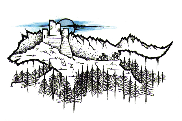

The Wolf’s Lair, Abruzzo
A mixed terrain bikepacking loop through Abruzzo, Italy, an incredibly diverse region set amongst the spectacular Apennines mountains. This never-ending series of gravel doubletrack, stunning landscapes, delicious food and medieval villages will lead you into the “wolf’s lair” to discover the wild side of Abruzzo.
The idea behind The Wolf’s Lair was to create a bikepacking route that links the three National Parks and one regional park of Abruzzo, a predominantly mountainous region located in central Italy. The result is a 388km loop on gravel, doubletrack and tarmac roads with over 8,500 meters in total ascent. Starting from the archaeological site of Amiternum, next to L’Aquila city, the route enters the Gran Sasso National Park and reaches the breathtaking Campo Imperatore plateau via a remote doubletrack road. There stands Corno Grande (2,912m), the highest peak of Gran Sasso d’Italia massif.
Heading south, the landscape changes dramatically. The luxuriant forests disappear in the bowel of the karst canyon formed by the river Orta. The 1,282 meter San Leonardo pass leads to the Maiella massif and into the heart of its National Park where you can admire crumbling primeval structures called “tholos”. For centuries shepherds used these as shelters to spend nights or wait out bad weather. From the Cinquemiglia plateau you will reach the Abruzzo National Park, the oldest in Italy and the richest in flora and fauna. Be prepared to see brutal wildlife scenes, such as the pregnant deer mauled by wolves shown in the photo below.
Last but not least is the Sirente Velino Regional Park, where you will remain in the shadow of the majestic Sirente Mountain until you reach Pagliare di Tione, a remote and ancient village where it feels as if time has stood still for a millinea.
The Wolfs Lair 2.0 (ROUTE UPDATE)
After three and a half years, we decided to update The Wolf’s Lair to explore more amazing places, replacing asphalt with singletrack, gravel, and doubletrack roads. This means there are about 65 kilometers of updated roads, 95% of which are off pavement. The new stretches are on the west side of the route. Watch the film here.
Highlights
Amiternum, starting point of the route, is an archaeological site where you can admire ruins of an ancient roman theatre and amphitheatre dating back to the 1st century BC.
Epic doubletrack road that leads to Campo Imperatore plateau in the shadow of Corno Grande peak.
Santo Stefano di Sessanio, one of the most beautiful fortified villages in Italy. The medieval atmosphere and the graceful architecture worth the visit.
Rocca Calascio, the highest mountaintop fortress in Italy (1460mt) and among the 15 most beautiful castles in the world by National Geographic.
Civitella Alfedena and its narrow alleys, where traditions are still alive, and the amazing view of Barrea Lake at his foot.
La Camosciara, a Nature Reserve within the Park and a natural amphitheatre whose rugged peaks have allowed the survival of chamois of Abruzzo and the Marsicano Bear, today symbol of Abruzzo National Park.
Sperone, a ghost town in the Marsica area.
Post-ride beers on the veranda of “Ristoro degli Elfi” in Santo Stefano di Sessanio.
Must Know
The Wolf’s Lair is mostly rideable and not very technical. It does contain a few rough sections but they can be walked if needed.
We rode gravel bikes to cover the loop. The bike choice was ok for tarmac and offroad track, although a monster-cross or a 29er mtb could work better for the roughest and steepest sections.
The ideal riding season is between mid-May and mid-September. The weather conditions can change quickly near mountains areas (especially in the Gran Sasso range), prepare yourselves accordingly.
In the National Parks and the surrounding areas lives the Apennine wolf and the Marsican brown bear. To date no case of attack by bear has been reported, but be careful of the wolves, especially in packs.
Camping
Single night wild camping is tolerated in the parks. Just some tips: set up late – strike early – stay out of sight of the main roads – #leavenotrace.
Great wild campsite near Passo San Leonardo with water fountain. (noted on the GPX).
Lodging is possible in some villages along the route.
Food/H2O
Drinking water is never an issue, there is plenty of water fountains along the route. (a few are noted on the GPX).
A “must-stop” is at Ristoro Mucciante, on the Gran Sasso plateau, for tasting pecorino cheese, salumi nostrani and the delicious arrosticini (barbecued lamb skewers).
Food can be bought from grocers in Tocco da Casauria, Campo di Giove, Villetta Barrea and Secinaro. (noted on the GPX).
You can satisfy your huge caloric deficit at Lo Scoiattolo, a rifugio-restaurant placed at Passo Godi. Their traditional Abruzzo cuisine is simply delicious, and the portions are massive!
Trail Notes
The singletrack in the Camosciara reserve, just after Civitella Alfedena village, can change in a river of sticky mud in wet weather.
Resources
Additional Resources
parcoabruzzo.it – the official webpage for the Abruzzo National Park.
gransassolagapark.it – the official webpage for the Gran Sasso e Laga National Park.
parcomajella.it – the official webpage for the Majella National Park.
parcosirentevelino.it – the official webpage for the Sirente Velino Regional Park.
MontanusWild.com – for the full set of photos from this trip.
Terms of Use: As with each bikepacking route guide published on BIKEPACKING.com, should you choose to cycle this route, do so at your own risk. Prior to setting out check current local weather, conditions, and land/road closures. While riding, obey all public and private land use restrictions and rules, carry proper safety and navigational equipment, and of course, follow the #leavenotrace guidelines. The information found herein is simply a planning resource to be used as a point of inspiration in conjunction with your own due-diligence. In spite of the fact that this route, associated GPS track (GPX and maps), and all route guidelines were prepared under diligent research by the specified contributor and/or contributors, the accuracy of such and judgement of the author is not guaranteed. BIKEPACKING.com LLC, its partners, associates, and contributors are in no way liable for personal injury, damage to personal property, or any other such situation that might happen to individual riders cycling or following this route.


Iceland Divide (North-South)
Just below the Arctic Circle, situated between the North American and Eurasian tectonic plates, a remote land emerges from the depths of the Atlantic Ocean, dominated by huge glaciers, ashen deserts, and mighty lava structures. Here, along the fault line that crosses the island from north to south, the incessant work of fire and ice traced a route that runs through a world of immeasurable desolation and enthralling beauty, the Icelandic Highlands.
Share Facebook 1887 Twitter Pinterest
Halfway between Great Britain and Greenland, Iceland is a volcanic island characterized by a deserted and uninhabited plateau in its inland, accessible only during the short window of the year when it isn’t covered by snow. The idea behind this route is to cross Iceland from the north coast to reach the south following the fault line of the mid-ocean ridge that crosses the island—hence the name “Divide”.
The Iceland Divide leaves the city of Akureyri in the north, located on Iceland’s longest fjord and follows doubletracks and gravel roads as it passes through lava fields, beside volcanic glaciers, and some of the most remote areas of Iceland. Make sure to read the Trail Notes below for a full route description…
DIFFICULTY
The Iceland Divide has a difficulty rating of 9, mainly due to extreme weather conditions. Rain and wind are almost constant, and at higher altitudes and on mountain passes it’s not uncommon to encounter hail storms and snowfall, even in the summer months. No doubt, the brutality of the storms is the real danger in the Highlands. They can be strong enough to lift even the fully loaded bikes like twigs and to knock riders to the ground. In these conditions, moving is often impossible. Powerful storms can last several hours, with wind speeds reaching 60 m/s (135 mph – 225 km/h), and gusts of up to 75 m/s (165 mph – 270 km/h). The other factors that contribute to the route’s 9 rating are the lack of food resupply opportunities and the presence of some river crossings that, due to the depth and the strength of the current, can require considerable effort to be overcome.
Highlights
Desert areas that look like those of the moon for their colors, desolation, and absence of vegetation. There are other places quite like these anywhere else in the world.
Wonderful waterfalls of Aldeyjarfoss, characterized by black basalt columns.
Riding through the solidified lava of the Frambuni lava field, the gateway to the Highlands.
The impressive silhouette of Krakatindur volcano, east of the Fjallabak Nature Reserve, and the primordial environment that surrounds it.
Views of Mount Maelifell, an almost perfectly conical volcano that stands alone in a black sand desert. It’s a stunning natural masterpiece and one of Iceland’s most iconic landmarks.
The tomb of Hjörleifur Hróðmarsson (killed in 875 AD), one of the first Viking explorers, located on the summit of the Hjörleifshöfdi promontory east of Vik. The tomb can be reached on foot through a path that climbs 200 meters along the west side of the promontory.
Hjörleifshöfdi cave on the black sand beach near Vik, with the silhouettes of the sea stacks Reynisfjara and Dyrhólaey standing out on the horizon.
Must Know
The access roads to the Highlands are closed for most of the year due to snow. The period during which it’s possible to ride the route is thus reduced to about three months, from the beginning of June to the end of August.
Bring clothing for cold weather, including a rainproof and windproof jacket.
We recommend a freestanding tent that can withstand strong winds, as the ground is mainly lava sand and doesn’t offer solid anchor points. Use your bike when rocks aren’t available to anchor the tent.
Bring a head net with you. The area near Lake Svartárvatn, gateway to the northern part of the Highlands, is infested with midges.
Public buses offer a valid and cheap connection between the Reykjavik and the towns of Akureyri (start) and Vík í Mýrdal (end). The buses are equipped with bike racks.
When crossing rivers, always look for the best passage at the moment, given that the flow and the course of the river can vary. The “classic” line for crossing using by 4×4 is often not the best choice for a crossing on foot or by bike. The tires of motor vehicles dig into the bottom of the river, increasing its depth.
River crossings can become dangerous during or after rain, and, in the case of glacial rivers, during warm periods. You may have to wait until late night or early morning to crossing certain glacial rivers during the summer.
In Iceland it’s strictly forbidden to leave the gravel and doubletrack roads, even by bike.
This route is best experienced on a fatbike.
Camping
In the Highlands, you have permission to pitch your tent anywhere for one night. #leavenotrace.
If you wish to camp near fenced off farmland, you have to ask permission from the landowner before you set up your tent.
There are some mountain huts along the route (see map). You’ll encounter the first two during the initial part of the route, about 8 km apart from each other. The first one is quite spartan and has 16 beds. The second one, Botni hut, also has 16 beds and a kerosene operated stove for heating and gas cooker for cooking. The third one, the Kistufell hut, is located at 1000 m altitude on the slopes of its namesake mountain, in one of the most remote areas of the route. This is a private hut that still remains open and available to those who may need it.
There are also staffed huts along the F26 and F210 where you can eat and sleep (very expensive), or camp in their campsite by paying a fee. There’s no possibility of food resupply here.
Food/H2O
Water is almost always available thanks to the many rivers and springs, except in the most desertic area between the Askja volcano and the Dyngjujökull glacier. The Kistufell hut has tanks of water inside that are available to those who need it. If these are empty, you must walk to a spring about 1 km southeast (see map).
Never take water from areas downstream of farms or fields. Instead, visit the farms and ask for the tap water.
Water from glacial rivers should be filtered.
Trail Notes
Leaving the city of Akureyri in the north, located on Iceland’s longest fjord, the route goes inland along a gravel road and then follows doubletrack just beyond the last human outpost, a farm near Lake Svartárvatn. From here, the green of the vegetation becomes sparse as you proceed, and the predominant color fades to the black of a huge stream of solidified lava mixed with lava sand. The desert views in the Suðurárhraun are impressive: devastation, desolation, and loneliness intermingle with an unmistakable feeling of disorientation.
To the south, the scenery becomes gloomy where a doubletrack sneaks along the Askja stratovolcano, over the mountain range Dyngjufjöll, and across the lava field of Frambuni. On the horizon, some lava formations stand out against the whiteness of Vatnajökull glacier, an impressive ice cap and the fourth mass of ice in the world. This is the most remote area of Iceland, and one with environments similar to those of the moon, so much so that in the ’60s, NASA chose this area to prepare the Apollo Astronauts for lunar exploration.
Passing the volcanic glacier Tungnafellsjökull to the north, the route intercepts the F26, a gravel road leading south through the Sprengisandur plateau, a black desert located between the east side of the Vatnajökull glacier and the subglacial volcano Hofsjökull. From the plateau’s 800 m elevation, you descend on a comfortable doubletrack to 250 m where the trail intercepts the F225, a gravel road that returns gradually to the mountainous region of Landmannalaugar in the Fjallabak Nature Reserve, a place known for its multicolored rhyolite mountains and its hot springs.
Back up at 600 m, you leave the comfortable gravel road for a doubletrack that rolls up and down before it reaches a desolated area in the direction of the Hekla volcano. Here, the wide expanses of black sand give way to mountains and volcanic formations like Krakatindur, a mass of rock that emerges from the Nyjahraun lava field like a ship’s bow. The view is breathtaking and the strong contrast between the black of the solidified lava flow and the bright green of moss that climbs up its slopes makes the landscape extraordinarily unique and unreal.
The route continues along doubletrack, sometimes using only the yellow posts stuck into the ground for reference, as the tracks are often erased by the floods coming from Mýrdalsjökull glacier, Iceland’s southernmost ice sheet. Continuing on, the trail encounters the distinct shape of Mt. Maelifell, majestic pyramid covered with green moss, sitting in the middle of a black desert. It serves as the exit from the otherworldly Icelandic Highlands. The final stretch of the route rolls on until it reaches the black sands and black pillars emerging from the sea in Vík í Mýrdal, the southernmost village in Iceland.
Resources
Additional Resources
Road conditions and weather in Iceland: www.road.is
Iceland Public Bus Transportation: www.straeto.is
Weather forecast from Icelandic Meteorological Office
Excellent camping and cheap option to stay in Reykjavik
Visit MontanusWild.com for the full set of photos from this trip


Alta Via dei Monti Liguri
The Alta Via dei Monti Liguri is a challenging and scenic bikepacking route that crosses Liguria, a coastal region of northwestern Italy between the jagged coast of Cinque Terre and the Maritime Alps. Following historical military roads, rocky singletrack, and steep alpine paths, the AVML flows through ancient rural settlements, fairytale beech-woods, mighty fortifications, and breathtaking valleys.
Share Facebook 750 Twitter Pinterest
The Alta Via dei Monti Liguri is a 488 km route that runs parallel to the coast from the Liguria region from La Spezia to Ventimiglia, a border town with France. This bikepacking route is a rework of the original track designed for trekkers starting from the town of La Spezia, on the east side of the region and near the famous tourist resort of the Cinque Terre. The Alta Via (trekking route) was officially founded in 1983 as a joint project of the Centro Studi Unioncamere Liguri, the CAI (Italian Alpine Club), and the Federazione Italiana Escursionismo (Italian Hiking Federation). However, in the early post-war years, a route almost entirely coinciding with the current Alta Via had already been reported by F.I.E. (Federazione Italiana Escursionismo) between Colle del Giovo (SV) hill and Colle Cento Croci (SP).
On the eastern side of the AVML, Dirt roards and singletrack trails alternate along the wonderful Levante coast among pine, chestnut trees and fern underbrush. The AV5T (Alta Via delle 5 Terre) goes into wilder areas, occasionally offering spectacular views of the Ligurian Sea where the rocky cliffs meet the water. The rocky, technical descent that leads towards the sea and the coastal town of Levanto is spectacular. After riding into an old converted railway tunnel, you start climbing to intercept the Alta Via dei Monti Liguri.
The central part of the route transits north of Genoa on a mix of dirt roads, singletrack trails, and deserted b-roads that pass through small, typical villages of the Ligurian hinterland. From there the Alta Via dei Monti Liguri route meanders through forests and lush meadows before continuing toward the west side where the terrain gets rougher as the altitude rises. In the western section, the AVML leaves the last slopes of the Apennines to approach the chain of the Maritime Alps, where mosses, lichens and very high conifers characterize the environment. A steady climb on comfortable dirt road leads to Monte Saccarello, the highest point (2170m) of the entire route and also the most distant from the sea (30km). After passing some military ruins you reach the summit, from which, on clear days, you can see Corsica at southeast and the pyramid-shaped Monviso (3841mt) at northwest. From there you start to lose altitude towards the sea, along the scenic Via del Sale (Salt road), an ancient dirt road once used to transport goods from the sea to northern Europe. After a few kilometers, the comfortable road gives way to a typically alpine singletrack with some short exposed sections (see “Difficulty”), which leads to the Gola di Gouta. From here, following a rugged ex-military road overlooking the Nervia Valley, you reach the town of Ventimiglia, where the Alta Via dei Monti Liguri ends.
Route Difficulty
The main difficulties of the AVML are represented by the considerable elevation gain of over 20,000 meters. This requires a solid physical preparation. In addition, the area is known for changing weather conditions which require adequate gear. The route passes over the mountains close to the sea and the formation of fog or the arrival of sudden rains are not rare. Also, be prepared for some hike-a-bike stretches on rough terrain. On the Fonte Dragurina pass (1810mt) there is a short via ferrata that requires caution (signed on the map), especially when traveling with loaded bikes (see photos in the gallery).
Route Development: The Alta Via dei Monti Liguri (Bikepacking route) mixes some stages of the Alta Via Stage Race (a XC marathon stage race) with some streches of Alta Via Info 24h route. We’d like to thank Lorenzo Carlini (from Alta Via Stage Race) and Claudio Simonetti (from Alta Via Info 24h) who helped us with some useful tips to track the bikepacking route.
Highlights
Traveling a unique route that starts from the sea to reach the Alps.
The incredible view of the cliffs overhanging the Cinque Terre.
The extraordinary view offered by the top of Mount Saccarello, where you can see on one side the entire chain of the Cottian Alps and Corsica on the other one.
The descent towards Levanto with the sea in the background.
Several old fortifications on the west side.
Traditional dishes of the local gastronomic culture. Liguria is home to “Genoese Pesto”.
Must Know
To facilitate the return by train once the route has been completed, the track starts from the La Spezia railway station and ends at the Ventimiglia station, whatever the direction of travel chosen.
The railway line runs along the coast and always remains between 15 and 20km from the route, so that the AVML can be traveled even partially, reaching the intermediate stations along the coast.
The best time to tackle this route is from June to October as the Alpine section can be covered by snow through the spring.
Bring mountain clothing, as there can be rapid changes in weather and sudden temperature drops at high altitudes, even during the summer months.
The AVML can be ridden from La Spezia towards Ventimiglia or from the opposite direction.
Most of the route is marked with red/white/red flags with the letters AV in the middle. The initial stretch that passes through the Cinque Terre is marked with the letters AV5T.
To ride this route we recommend a plus-tire bike with suspension fork.
Camping
Wild camping is generally tolerated. Best to set up camp at dusk and move on at dawn. #leavenotrace
In some parts of the route there are small cabines or votive chapels, which in case of need, can be used as shelter for the night.
Along the route there are also several accommodation facilities, from cabines to hotels.
Food/H2O
Generally speaking, there are plenty of hotels, restaurants, bars, and general markets along the route so food is never a problem.
Water is not a problem either, there are few sources and several livestock fountains. In the villages you will almost always find a fountain where you can refill.
Sometimes in the larger towns there are general stores.
You can satisfy your huge caloric deficit at “Hotel Paretin”, an hotel-restaurant located at Cabanne. Their traditional ligurian cuisine is simply delicious, and the portions are massive!
Resources
Additional Resources
altaviainfoh24.com provides a range of services regarding AVML, including a telephone assistance service for Alta Via visitors, free and available 24 hours a day, in 3 languages (Italian, English and French)
Visit MontanusWild.com For the full set of photos from this trip.
BeActiveLiguria.it For additional route and tourism information in the area.


Tour des Combins
The Tour des Combins begins at the Gran San Bernardo, a historically rich, windswept pass in the heart of the Pennine Alps. From there this three day trans-alpine loop alternates between lush valleys full of streams, marmots and majestic coniferous forests to more rugged and rocky mountainsides, where glaciers paint spectacular views of most impressive 4000 meter alpine peaks.
Share Facebook 423 Twitter Pinterest
Despite being one of the most scenic trans-Alps routes, Tour des Combins is one of the least known. Lodged between the Mont Blanc massif and the Matterhorn, the TdC circumnavigates the slopes of the Combins Range (4,314m) starting from the Gran San Bernardo Pass (2,473m), on the border between Italy and Switzerland. After the pass the route crosses the Gran San Bernardo valley on the Italian side using panoramic singletrack. For a short stretch it overlaps the ancient Via Francigena, a medieval 1800km pilgrim trail from Canterbury UK to Rome. The route continues on singletrack trails and doubletrack roads between the beautiful valleys of the Valle d’Aosta, the Menouve, and the Conca di By. From there, working counterclockwise, the TDC pushes into alpine meadows and coniferous woods, dominated by the snowy peaks of Mont Vèlan, Gelè, and the Grand Combin.
The TdC has a few challenging hike-a-bikes, such as that leading to the Fenêtre de Durand (2,797 m), a border crossing to enter Switzerland and the highest point of the route. Here, in the most remote area on the TdC, the landscape changes radically. Waterfalls, glacial rivers and sharp peaks offer epic high mountain scenery. However, the difficult push to reach the Fenêtre de Durand pass is rewarded by a magnificent singletrack descent towards the turquoise lake of Mauvoisin with another amazing backdrop.
After passing the town of Fionnay the Tour Du Combins climbs among typical alpine meadows, first on a steep but rideable gravel road and then on singletrack to reach the Col de Mille, another alpine pass at an altitude of 2,472m. From here the view is extraordinary with the eastern side of the Mont Blanc Massif as a background for the descent that leads to the small village of Bourg Saint Pierre. The TdC continues through Val d’Entremont to reach the border crossing with Italy, where stands the outline of the Grand Saint Bernard Hospice, which is home to the famous St Bernard dog (see highlights).
Difficulty: This route has been assigned an 7.5 due to the high altitude gain and a couple of very challenging hike-a-bikes. The first one you meet, on the mountain above the village of Saint-Rhémy-en-Bosses, is very steep and forces you to either shoulder the bike or climb step by step with the bike in front of you. There are also two other short stretches both in the Conca di By. The first is a very narrow passage between the rocks where you have to pass the bike keeping it vertically on the rear wheel, the second is an easy stretch of via ferrata where you have to proceed with caution due to the weight of the loaded bikes.
Note that this loop can be easily connected to the most famous Tour du Mont Blanc to create an incredible and challenging bikepacking route.
Highlights
The Hospice du Grand Saint Bernard was built by Saint Bernard around 1050 A.D. to provide assistance pilgrims and travelers who ventured over that fearful pass. From the mid-seventeenth century, the monks of the Hospice began to use big mountain dogs to rescue travelers or pilgrims who had been lost in the snow or fog, or those who were caught in an avalanche. Thus was born the myth of the Saint Bernard rescue dog.
60 meters of ancient Roman road dug directly into the rock between 41-54 A.D., commissioned by Emperor Claudius. You will ride this section after passing the statue of San Bernardo on the hill with the same name.
The astonishing view of the Mont Blanc massif from the Col du Mille.
Fantastic singletrack descent from the Fenêtre de Durand pass to the Drance du Bagnes river. Incredibly fun in the first part, however it becomes steep and technical in the latter half.
Epic views from Fenêtre de Durand towards the glacier d’Otemma.
Old Swiss customs house in Bourg Saint Pierre dating back to 1901. Cigarette smugglers are depicted on the front side.
Must Know
A trail bike such as a plus-hardtail is recommended for this route. A suspension fork is highly recommended as there are several technical descents.
The route is only rideable from mid-June to mid-September, when all the passes are free from snow. Because of the abundant snowfall at high altitude, even the paved road to the San Bernardo pass remains closed for 8 months a year. However, as Alexander mentioned in the comments, “… refrain from doing this trip until July. Last winter for instance saw little snow, yet around mid-June Fenetre de Durand on the Swiss side was full of snow with strong water streams hidden.”
Carry mountain weather clothing and gear with you and be prepared as snow and sudden temperature drops are all but rare on the high passes… even in the summer months.
We recommend to do the Tour du Combins counterclockwise.
Most of the route is marked with a yellow diamond with black outline, which sometimes bears the letters “TDC” in the center.
Camping
In Switzerland wild camping is not generally encouraged, but is tolerated. However, according to the Swiss Apline Club, camping above treeline is accepted. So set up late, strike early, be discreet, and leave it as you found it.
If necessary, on the Col de Mille there is the Cabanne de Mille refuge, where you can eat and sleep.
There is an official camping spot in Foret des Melezes.
Food/H2O
Water is never a problem: it’s plenty of streams and rivers along the route, and fountains with drinking water are frequent in the villages.
If necessary, you can refuel in a market in the small village of Lourtier (Switzerland).


Tour du Mont Blanc
A spectacular alpine route circling the massif of Mont Blanc — the roof of the Old Continent — and crossing the borders of Italy, France and Switzerland. Once considered a horrific place, inhabited by demons and dragons, turns out to be an incredible display of alpine beauty where sheer granite walls rise between impending glaciers, long gravelly moraines, meadows and enchanted valleys.
Share Facebook 1675 Twitter Pinterest
The mountains before the 18th century were considered arcane places, full of dangers, inhabited by monstrous creatures, where huge white dragons (i.e. glaciers) descended from the heights to haul away and devour those who wished to violate their territory. The conquest of Mont Blanc in 1786 marks the beginning of a different approach to the mountains, still an unknown place yet to be explored — the birth of Alpinism.
A different approach is also necessary when bikepacking the Tour du Mont Blanc (TMB), one of the most popular long-distance circular treks in Europe. The urge to pedal must meld with the attitude of the mountains and to all that it involves. The Tour du Mont Blanc is an alpine voyage that fills the heart and empties the lungs. For a detailed description of the route, click the Trail Notes tab below.
Highlights
Amazing views on Val Veny and Val Ferret, two beautiful glacial valleys that run along the entire italian side of the Mont Blanc Massif.
The monuments of the conquest of Mont Blanc (1786) in the Chamonix square. The first of 1887 is dedicated to Balmat De Saussure and the second was opened 100 years later to return M.G.Paccard about who was the real soul of the undertaking.
The bearded vulture (Gypaetus barbatus) it’s one of the biggest vulture which nesting in the old continent. It’s possible to spot this rare bird of prey, recently reintroduced on the Alps, in the most mountainous areas of the route.
The Marmot (Marmota) a sort of large squirrel, will accompany you along most of the route with its typical whistle. It’s a warning signal used to communicate your presence to the others marmots. It’s indeed the cutest animal of the TMB.
Weird wooden sculptures along the trail in the wood after Champex-Lac, in Switzerland.
Must Know
This route of TMB deviates from the classic route and requires good physical preparation. However, there are several paths to reduce the total ascent and bypass some of the toughest climbs.
The best time to face the TMB is from mid-June until mid-September. In June the higher mountain passes may still be snow-covered. During July and August the trails are crowded with hikers, while in later September you can experience the TMB in amore intimate way.
The TMB can be ridden clockwise or counterclockwise. Many people choose to start from Chamonix or Les Houches in France, others from Courmayeur in Italy, but you can choose any point along the route.
Take high mountain clothes with you. Abrupt changes in weather can lead to sudden snowfalls even in the summer months.
Don’t’ forget to wear sunscreen.
The long, steep descents and the weight of the bike in bikepacking mode devour the brake pads. Take with you at least one spare pair.
In the towns of Chamonix and Les Houches, there are some well-stocked bike shops.
Camping
Wild camping is not generally encouraged, but is tolerated. Set up camp in responsible places. Be discreet. #leavenotrace
For those who don’t want to have a self-supported adventure there are many shelters along the route where you can sleep and eat. In the summer months, given the turnout, it’s recommended to book, while from mid-September many of them are already closed.
Food/H2O
The massif of Mont Blanc with its glaciers and permanent snow ensures a steady supply of water along the route. (Rivers and creeks in the mountain/ fountains in the villages).
You can resupply at the general stores in Courmayeur (Italy), Les Houches and Chamonix (France) and in the small village of Le Fouly (Switzerland).
Trail Notes
Trail Description
The TMB starts in a clockwise direction from Courmayeur, a small italian town located at the foot of the southern side of Mont Blanc. It quickly reaches 2,000 meters in altitude and the majestic scenery offered by the Aiguille Noire de Peuterey and the mighty glacier of Brenva that flows down valley from the summit of Mont Blanc. By way of a hike-a-bike trail you reach the Mont Favre at 2400mt before falling back to the most spectacular area of the Val Veny, where Dora of Vény river, the incredible Miage glacier, lake Combal, Aiguille des Glaciers and the unmistakable silhouettes of Calcaires Pyramides on the horizon paint an ice-age setting of incomparable beauty.
A comfortable gravel road runs through the valley and after passing some dilapidated military barracks, reaches the high Val Veny, a vast isolated plateau that allows you to catch your breath before start to climb again along a trail that leads to the Col de la Seigne (2512mt) on the border between Italy and France. Arriving here just before sunset means you will enjoy the most beautiful descent of the whole Tour immersed in a surreal atmosphere: the sweet flowing singletrack, the Vallée des Glaciers and peaks on the horizon, all is dyed of gold. After losing about 1000 mt in altitude and passed the small village of Les Chapieux, it rises again to face one of the toughest stretches of the TMB, the climb to the Col du Bonhomme (2,483mt) where the narrow, steep and often rough track will make you curse every the added grams loaded on your bike. However, the Alpine environment and the scenic views offered by the surrounding valleys will reward the effort.
The singletrack descent, initially tight and technical, becomes smoother and comfortable as you get closer to the valley where a gravel road leading into the town of Les Contamines. From here you’ll climb a steep fire road to reach Col de Voza, then cross the tracks of the Tramway du Mont Blanc to go down to the village of Les Houches, along an old school crumbly downhill track. The route continues on singletrack through the forest, running along the north side of the Arve valley, where through the branches of the pine trees, you see the majestic Glacier du Bossom and overhanging peaks of the Aiguille du Midi and the Aiguille du Dru.
After the traditional alpine village of Chamonix, you will reach the town of Le Tour where a jeep road reaches the Col de Balme at 2195mt on the border of France and Switzerland. From here a long, scenic singletrack runs the west side of the Croix de Fer and then enters the forest, where it becomes rocky and very technical. From the valley of Trient you’ll climb to the amphitheater of the namesake glacier to overcome the glacial river through a wooden bridge and reach the pass of the Col de la Forclaz. A steep narrow path climbs to the Alp Bovine becoming increasingly challenging in the final stretch where boulders along the trail force you to lift the front wheel.
The route continues between alpine pasture and forest to reach the valley bottom through a steep descent on loose rock that winds between boulders and ancient trees uprooted by winter avalanches. Back in the valley you’ll climb the swiss side of Val Ferret, cross the village of Le Fouly and with a succession of trails and fire roads you reach the Col du Grand Ferret at 2,537 mt altitude, on the Swiss-Italian border. From here the view of the Italian Val Ferret is breathtaking. The return to Chamonix is done by traversing the mountain side, a panoramic balcony on the northeastern side of the Mont Blanc massif: from Mont Dolent to the Aiguille de Triolet, from the Grandes Jorasses to the Giant’s Tooth, until the 4810mt summit of Mont Blanc.
Resources
Additional Resources
autourdumontblanc.com is a site plenty of useful info about the TMB route.
Visit MontanusWild.com – For the full set of photos from this trip.
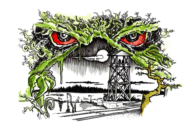

Swamp Thing Trail: Exploring The Estonian Taiga
There is a trail in the northeast of the old continent that crosses a medley of floodplain taiga, quicksand, swamp, meadows, bogs, and intercepts the East-Atlantic migratory path of Arctic waterfowl. This place holds a multitude of rivers and lakes that lead to the extraordinary and isolated coasts of the Baltic Sea. Welcome to the wild heart of Estonia.
The Swamp Thing Trail is a 386km route that runs from south to north through the nation of Estonia, one of the most forest-rich countries in the world. The route is named after The Swamp Thing, a comic book from the 1970s which depicts a swamp monster — a humanoid mass of vegetable matter — who fights to protect his swamp home and the environment in general. The route name is fitting not only for the unique ecosystems and scenery which it passes through, but also considering Estonia’s environmental plight. After regaining independence in the 1990s, Estonia has made an effort to protect and enhance its flora and fauna throughout the country.
The ride starts from Pärnu, a small city on Estonia’s west coast. After penetrating a majestic coniferous forest, a rusted and decorative bridge along an old abandoned railway escorts in the Laiksaare forest. From there, a series of empty gravel roads alternate with singletrack to immerse you in the Estonian wilderness, between carpets of moss and lichens, wild berries and mushrooms. The primordial bog landscapes offer a spectacle like no other, where the lights of dusk and dawn move with the mist along these endless lowlands. The observation towers are the best place to watch this unfold.
The singletrack is never overly technical, and there is very little elevation gain. What makes this route deserve a seven on the difficulty scale are the constant mosquitoes as well as the ever-present challenge to access drinking water. The water resupply points are very rare and the rivers and channels have a brownish-orange color and must be purified. Another pitfall is the unpredictable flooding which can require waist-deep wading, or in extreme cases, improvisation of alternative tracks to continue the route.
After crossing the Soomaa National Park and Kõrvemaa Landscape Reserve, estonian forest will take you through the Lahemaa National Park in one of the most amazing places of the entire route: Mädalaht bay on the Käsmu Peninsula. Large stone fields, fine sand, tall conifers right on the coast, and Devil’s island on the horizon make this the most incredible place on the Baltic Sea. And don’t forget to take a dip in its icy waters.
Highlights
Surju Train Station was built in 1896 under the Tsar Nicholas II, the last Emperor of Russia. It’s an estonian cultural monument.
Farm Museum of C. R. Jakobson at Kurgja and The flour and saw watermill, built in 1879, at the Pärnu River worth a visit.
Soomaa Nature Center in the Soomaa National Park. Here you can have information materials and watch films about the Park. You can also explore the flora of Central Estonia, the cultural history, and experience the fifth season of Soomaa – the flood.
In the Centre it’s possible to see the exhibition of the epic “Fifth Season” of 2010.
Estonian forests are populated by european lynx, brown bears, wolves, moose, beavers and flying squirrels that can only be seen in Estonia and Sweden. You can also meet a lot of galliformes as the Hazel Grouse, the Capercaillie and the Grouse. Flocks of white storks will often accompany your trip.
Observation tower near Lake Paukjärve. A sort of time machine on which it’s worth going to watch the primitive bog landscapes.
Swimming in the Baltic Sea. The Mädalaht bay, at the end of the trail, is the best place to do this, and have chilling time and a beer!
Must Know
The best time to tackle this route is from June to August, with temperatures ranging from 10° C to 20° C. July and August, however, are the wettest months.
Pärnu, the trail starting point, is easily reaching by train from Tallinn and bikes may be transported without additional cost.
Don’t forget anti-mosquito net hat and a ton of repellent.
If anybody should give you a Vodka, drink it in one shot without coughing!
The trail is mainly made up of empty gravel roads and singletracks, never really technical except in brief steps.
The floods can inundate large areas, and you may find yourself facing deep fords without the possibility of bypass them. Crocs might come in handy.
Camping
Along the trail we counted 9 campsites and 18 campfires, equipped with outdoor fireplaces, fire rings with barbecue grill, shelters with table and benches, trash cans and dry toilets.
There are 5 forest huts that can be used free of charge. Inside you will find tables, benches/platform beds and in someone even fireplace.
Food/H2O
There are 3 points for sourcing of drinking water along the trail: a well near the Laiksaare Forest District and two fountains, one at the Sooma Nature Center and the other in the Campsite of Võsu (All noted on the GPX). The water has a metallic taste, but you will appreciate it.
Along the trail you can pick wild blueberries and apples. Super tasty and great natural energy if necessary.
In the town of Kurgia, inside the water mill, near the “Farm Museum of C. R. Jakobson,” you can buy mineral water bottles.
There’s a general store in the borough of Lelle, about halfway through the route. It is small but well-stocked.
The second and last market where you can resupply is in the village of Aegviidu.
Resources
Additional Resources
rmk.ee – the official webpage for State Forest Management Centre. The site contains useful information about campsites, campfires and huts along the route.
Visit MontanusWild.com – For the full set of photos from this trip.


Bikepacking Sibillini (Italy)
Surrounded by the spectacular mountains of Marche region, Monti Sibillini National Park offers a 3-4 day bikepacking loop around one of the most impressive and spectacular massifs on the Italian peninsula. The route follows gravel roads and singletrack trails through enchanting and timeless landscapes where many myths and medieval legends began...
Share Facebook 663 Twitter Pinterest
The Sibillini Mountains have been a popular subject for travelers and explorers since the fifteenth century, stirring a sinister and mysterious charm in the imaginations of scholars and adventurers from all over Europe. As legend has it, one of its peaks was home to an ancient oracle called Sibilla. Even today, centuries later, the Sibillini Mountains inspire a sense of magic to those who travel these tracks.
Starting from the ancient village of Visso, the Sibillini bikepacking route offers an incredible variety of ecozones and panoramas in close succession, despite its limited mileage. Following gravel and double track dirt roads, this 158 kilometer clockwise loop provides a complete view of the massif. From the wonderful Val di Panico (Panic Valley) which goes towards the mountains lapping the “Dolomitic” Monte Bove, to the ever blue lake of Fiastra, where you can taste the delicacies of Italian cuisine and swim in its crystal clear waters. On the east side, in Prati di Ragnolo area, there’s a beautiful dirt road that flows through a high meadows with breathtaking panoramic views of the Sibillini to the west overlooking the wild valleys of the Ambro and Infernaccio, the Marche hills, and the Adriatic Sea to the east.
The route is mostly rideable and even the singletrack sections aren’t too technical. For the most part, the only bike dismounts required are to take in the views. Among these views are certainly the Piana di Castelluccio, which can be seen from the Forca di Presta pass in the southern part of the route. From there you can also admire the magnificent silhouette of the Monti della Laga.
From that pass in the south, while rolling through Pian Piccolo and Pian Grande which make up the Castelluccio plateau, you’ll follow a series of grassy trails and doubletrack towards the town of Castelluccio in the shadow of Monte Vettore, the Sibillini’s highest peak (2476m). If you time it right between the end of May and the beginning of July, an incredible array of wildflowers bloom and paint the entire plateau. After reaching the route’s highest point (1820m) in the east, you drop back down to Visso (600m), the starting point of the loop, over a series of double tracks and winding gravel.
Bikepacking in Sibillini is somewhat of a mystical experience. All throughout the ride you’re immersed in a seemingly magical atmosphere where it’s easy to lose yourself in the surreal landscapes and tracks that wind between the folds of the mountains and disappear into the boundless meadows. Here the light captures glimpses of timeless beauty where remote valleys are punctuated by pyramid-shaped mountains.
Route Development
We originally rode in Sibillini National Park in 2016 when we pedaled the G.A.S. (Grande Anello dei Sibillini), one of the most beautiful hiking paths in central Italy. Two months later an earthquake struck the Sibillini area and the access to many of the sections we rode were closed for safety reasons. Three years later many of those areas have been reopened. This route was based on a specially designed version of the G.A.S. and is the result of the joint efforts of locals Ivano D’Orazio, Fabrizio Castelli, and Loretta Piergentili. We’d like to thank them for inviting us back to the Sibillini Mountains. Their Association Marche Bikepacking organizes “Sibillini Bikepacking,” the first unsupported bikepacking event in the Sibillini National Park which will be held in May this year. Learn more at sibillinibikepacking.it.
Highlights
The spectacular views from Fiastra Lake and the trail that runs along the eastern shore.
The Sanctuary of Macereto which stands on an isolated plateau in the western side of the route. It’s a religious complex and one of the greatest expressions of Renaissance architecture of the 16th century in the Marche region. It can be reached with a detour of 1.5km from the route, but it’s definitely worth it!
Epic view of the Adriatic sea along the Prati di Ragnolo near Pizzo Meta in the north-eastern side of the route.
From the Forca di Presta pass. At 1,550m, you can enjoy the spectacular views of the Piana di Castelluccio, and in the opposite direction, the peaks of Monti della Laga.
Epic view of Monte Vettore, the highest peak in the Sibillini mountains (2476m), whose top stands out over the Castelluccio plains.
Fiorita di Castelluccio, between late May and early July you can admire the array of wildflowers that bloom on the plateau, bursting with colors ranging from yellow ochre to red, from violet to white. The species of flowers that paint the Piana di Castelluccio include lentils, gentianella, buttercups, poppies, narcissuses, violets, asphodels, Eugeniae violet, clovers, oxalis, and many more.
The Italian-shaped forest near the plain of Castelluccio where conifers were planted in 1961 in memory of the nation’s first centenary of unity.
Must Know
The Monti Sibillini area was hit hard by an earthquake in 2016. It is therefore recommended not to enter the “red zones” of the historic centers of Visso, Ussita, and Castelluccio villages.
Best bike: a hardtail MTB or fully rigid plus bike is recommended for this mixed-terrain loop. Even a gravel bike would work, especially with wide and tough tires (700x45mm or 650b x 2.1″) due to some rough sections.
When to go: the ideal riding season is between mid-May and mid-October. In winter some sections of the route are not passable due to the snow.
The route passes through grazing areas where there could be sheepdogs. If they chase you, the best way to proceed is to get off the bike and continue on foot, placing the bike between you and the dog.
Camping
Wild camping is permitted along the route, except for the Castelluccio plateau (from Km120 to 129 /from mi 74.5 to 80). As always, #leavenotrace.
Just before the no camping zone, there’s an excellent location to pitch a tent or bivy. It is close to the Belvedere mountain hut and offers a spectacular view of the Monti della Laga.
Campfires are banned in the Sibillini National Park.
There are two campsites along the route. ‘B-Site Camp’ on the banks of Fiastra lake and ‘Camping Sibilla’ in Montefortino (both noted on the GPX).
Lodging is possible in some villages along the route or nearby. More info here.
Food/H2O
Drinking water is never an issue. There is plenty of water fountains along the route. The only stretch where there is no water supply is between Castelluccio and Visso (about 25km).
On the Fiastra lake there is “La Spiaggetta” where you can eat, and if necessary, repair your bike thanks to a bike repair station. In front of the restaurant there is also a small beach where you can relax.
A “must-stop” is at La Capanna in Pintura where you can enjoy typical cuisine, take sandwiches, or even sleep. There is also a bike repair station available for riders.
Food can be bought from grocers in Visso and Fiastra (noted on the GPX).
Resources
Additional Resources
Sibillinibikepacking.it the official webpage for the Sibillini bikepacking event.
Sibillini.net is the official webpage for the Sibillini National Park.
MontanusWild.com – for the full set of photos from this trip.


Malecoste Overnighter
The Malecoste Overnighter was designed as a mountain escape from the outskirts of L’Aquila, an historic town in central Italy. In its relatively short distance, the route goes deep into the Gran Sasso National Park, exploring the western and lesser-known side of the Gran Sasso mountain range along two-track roads and faint singletrack that leads into the rocky amphitheater of Chiarino Valley.
This loop was conceived to pay tribute to the place where Montanus was born. In the summer of 2014, we took our first overnighter in the Chiarino valley, riding full-suspension bikes with massive backpacks. Six years later we returned there to create a loop to remember the old days and celebrate our origins. The Malecoste overnighter follows a mix of singletrack and two-track roads across plateaus, forests, streams, and valleys to reach the majestic Apenninic peaks. It’s kind of a microcosm of incredible biodiversity. The area is full of wild animals, such as horses, wolves, fox, eagles, and griffon vultures, as well as an incredible variety of plants and wild flowers. It’s amazing what it’s possible to see within a route that’s only 60 kilometers in length.
Passing Monte Jenca and Pizzo Camarda, steep but rideable uphills take you in the “high mountain” section of the route where you’ll need to walk your bike along faint tracks to reach Passo Malecoste, the highest point of the route 7,313 feet (2,229 meters). This is the most spectacular part of this overnighter, an incredible natural amphitheater made up of rock walls, scree, loose rocks, and boulders. Malecoste is sort of wall of petrified flames at the top of a valley. Monte Corvo and the north face of Pizzo Camarda leave you breathless as much as the amazing view on the Chiarino valley and the Campotosto Lake across the horizon.
Difficulty: Just to be clear, this is not an overnighter for beginners. It can be described as an “alpine route” with all that it implies in terms of beauty and difficulty. Bikepackers need to be prepared for steep uphills, hike-a-bikes, some techy downhills and potential snowfield crossings in the spring. This route is physically challenging with a lot of elevation in just a few miles, so we chose to give it 8/10 in difficulty. See “Must Know” section for details about what type of bike works best.
Highlights
View of the western side of Gran Sasso d’Italia and Corno Grande (2914 m), the highest peak of the mountain range.
Views of Mount Malecoste and its unique shape that’s reminiscent of a wall of petrified flames.
The massive Monte Corvo (2623m), one of the most beautiful and remote mountains of the Gran Sasso range.
Views of Val Chiarino and the rocky peaks at the top of the valley (Monte Corvo and Pizzo Camarda).
Orapi (Chenopodium bonus-henricus) are wild spinach that grows over 2000m. They is an endemic species of this in the Gran Sasso mountains. You can find orapi in the Chiarino Valley during the spring, and they’re perfect to prepare a tasty wild food mixture with leaves of Ursino garlic (Allium ursinum), that grows in the same valley.
Passo del Belvedere (1789 m) and the views over Monti della Laga mountain range and Campotosto Lake.
A post-ride wood fired pizza at “Il Vecchio Forno” is a must. The pizzeria is located at the end of the route in the small village of Arischia.
Amazing artisanal gelato at “Bar Centrale” in Arischia.
A pic-nic area and a butchery at the end of the route are strategically located just in case of a post-ride BBQ. You can’t miss the super tasty local “arrosticini”.
Must Know
Take high mountain clothing with you, even in the summer. Weather and temperatures can suddenly change, especially over in highest part of the route.
Best bike: a front suspended or full-suspension bike are recommended for this mountain route. It’s not a route for gravel bikes.
When to go: the ideal riding season is between mid-May and mid-October. Consider that you may have to cross some snowfields in May/June. It’s depends on the amount of snow has fallen in the winter.
Camping
This overnighter was designed with two options to camp, both close to a water source (spring). The first one is at Passo del Belvedere and the second one is in the Chiarino valley, where the route meets a stream. The choice depends on your speed and fitness.
Rifugio Fioretti (1503 m) at km 38 can be the third option. It’s located at the bottom of Chiarino Valley, but you’d need to move at a quick pace to reach it. The refugio features a small room that’s always open with a fireplace and enough space for 2-3 people. It’s also a nice option in the event of bad weather.
Food/H2O
Drinking water is never an issue on the route, thanks to water fountains and streams along the way. Note that the fountain in Passo del Belvedere (KM 25.8) is located at the end of a singletrack that leaves the route for about 1km. The singletrack is flat and all rideable.
Food can be bought from two grocery stores (noted on the GPX) in the small village of Arischia, close to the start of the route. There is no food resupply along the route
Resources
Additional Resources
MontanusWild.com for the full set of photos from this trip.


The Bruschetta Loop, Italy
The Bruschetta Loop is an overnighter bikepacking route in the sub-Appenninic region of central Italy along the Simbruini Mountains on the border between Abruzzo and Lazio. Doubletrack and gravel roads cross the largest beechwoods in Europe and then reach gorgeous karstic plateaus. A short ride to enjoy a mini-adventure between the valleys that have been captured in spaghetti-western films.
Share Facebook Twitter Pinterest
Bruschetta is a peasant dish and a famous appetizer in Italy made from Italian bread, garlic and olive oil, easy to prepare and incredibly tasty. This route has the same features… it is a simple and beautiful ride doable on an easy sub-24 overnighter bikepacking trip.
The “Bruschetta loop” starts from Marsia, a small village in the west of Abruzzo at 1500 meters above sea level. There a wide gravel road will take you first to Piano del Pozzo, an area with some paths for cattle herding, then to Piano la Sella, a beautiful prehistoric-like valley along the southern slope. After passing the small village of Camporotondo (1450 meters) you quickly reach the Cesa Cotta plateau, the widest along the route. The magic of the “Bruschetta Loop” is in the crossing of the many plateaus in the area of the Simbruini Mountains, like a corridor joining several rooms in which woods, hills and grassy meadows paint new and enchanting scenarios.
The southern portion of the route runs along the initial stretch of Fosso Fioio, a scenic canyon featuring pinnacles of limestone rock. This was once the border between the Papal State and the Kingdom of the Two Sicilies. After about four kilometers the route leaves the canyon and climbs through a rough dirt road until you reach Piano Morbano, a gorgeous plateau located in the center of the loop and among the most beautiful meadows to camp, observe the starry sky surrounded by huge beech trees, and have a tasty bruschetta accompanied by an excellent craft beer. Majestic beech trees, enchated valleys and peaceful plateaus will accompany you on doubletrack roads to return from the northwest to Marsia, the starting point.
Highlights
Beautiful submontane scenery and wildlife.
Riding along ancient borders between the Papal State and the Kingdom of the Two Sicilies delimited by boundary stones installed in 1847, in number of 680 and along the route you will find some of that near the canyon of Fosso Fioio. They have a cylindrical shape, on one side they have engraved the keys of St. Peter, symbol of the Papal State, and on the other one the Lily, symbol of the Kingdom of the Two Sicilies.
Incredible view from Cesa Cotta plateau to Monte Cotento (2015 s.l.m) the highest peak of the Simbruini Mountains.
Riding in Western Spaghetti scenarios, where in the 70s Sergio Leone filmed some scenes from his famous movies.
Must Know
Most of the route has no technical difficulties and can also be ride with a gravel bike (40mm +). Only a couple of climbs are bumpy and have surface roots that could put the skinny tires in trouble.
The best time to deal with this route is from May to November, while in the other months it is possible that snow will make it impracticable.
There are some shelters along the route but they are closed.
Camping
The route offers a lot of opportunities for easy wild camping. Be discreet and #leavenotrace
At the starting point of the route there is a camping (Europing Di Marsia) with a diner.
Food/H2O
There are plenty of springs on the route (showed in the map).
The only point along the route where you can resupply is the mini-market in the small town of Camporotondo.
Bruschetta (pron. Brusketta) recipe: roast a slice of rustic italian bread, sprinkle it with extra virgin olive oil and add salt (more or less to taste). If you sleep alone in the tent you can spruce up the bruschetta by rubbing some garlic on the bread.
Along the route you can find super-tasty wild strawberries between spring and summer.
Resources
Additional Resources
Visit MontanusWild.com – For the full set of photos from this trip.