

Cordillera de Fuego
Bìo Bìo / Araucanìa - CHILE
HIGH POINT
1870 m
DIFFICULTY (1/10)
7,5
DISTANCE
513 Km
DAYS
10 / 11
% SINGLETRACK
10%
% UNPAVED
79%
TOTAL ASCENT
10.894 m
% RIDEABLE TIME
95%
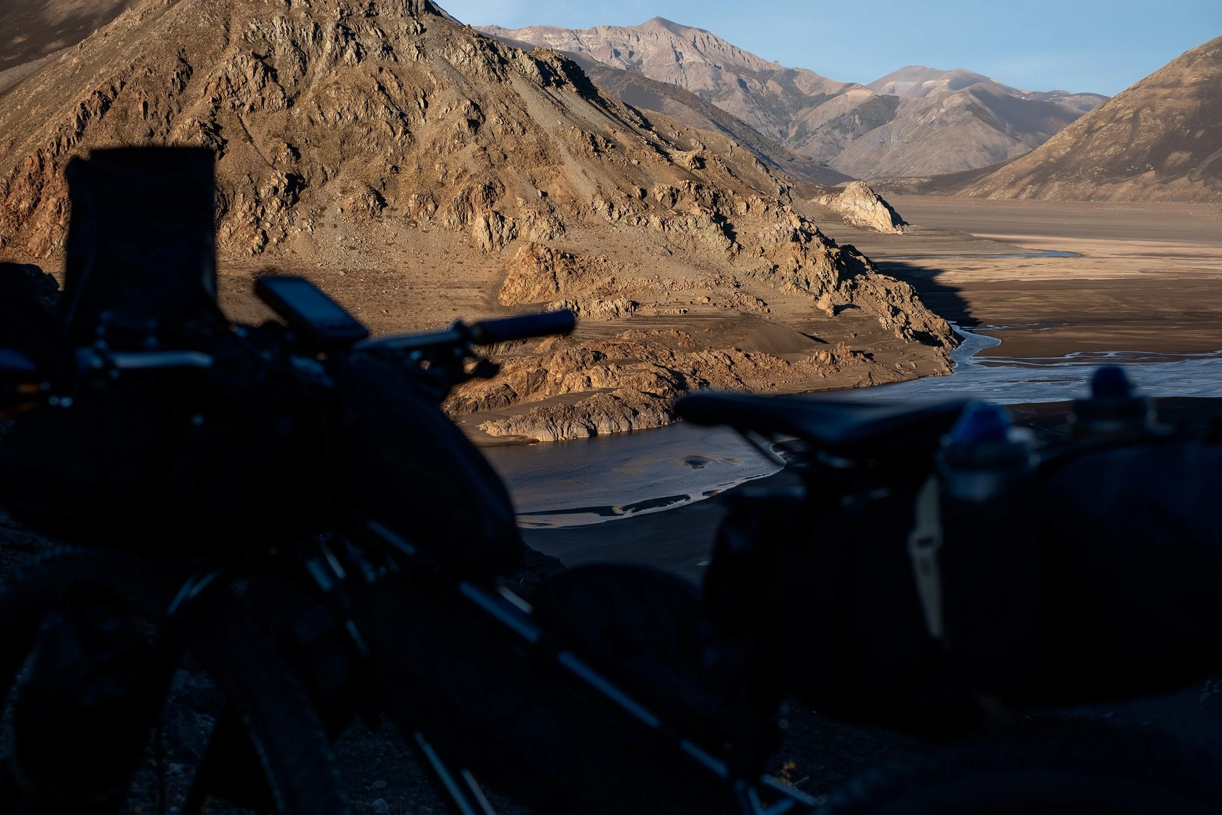
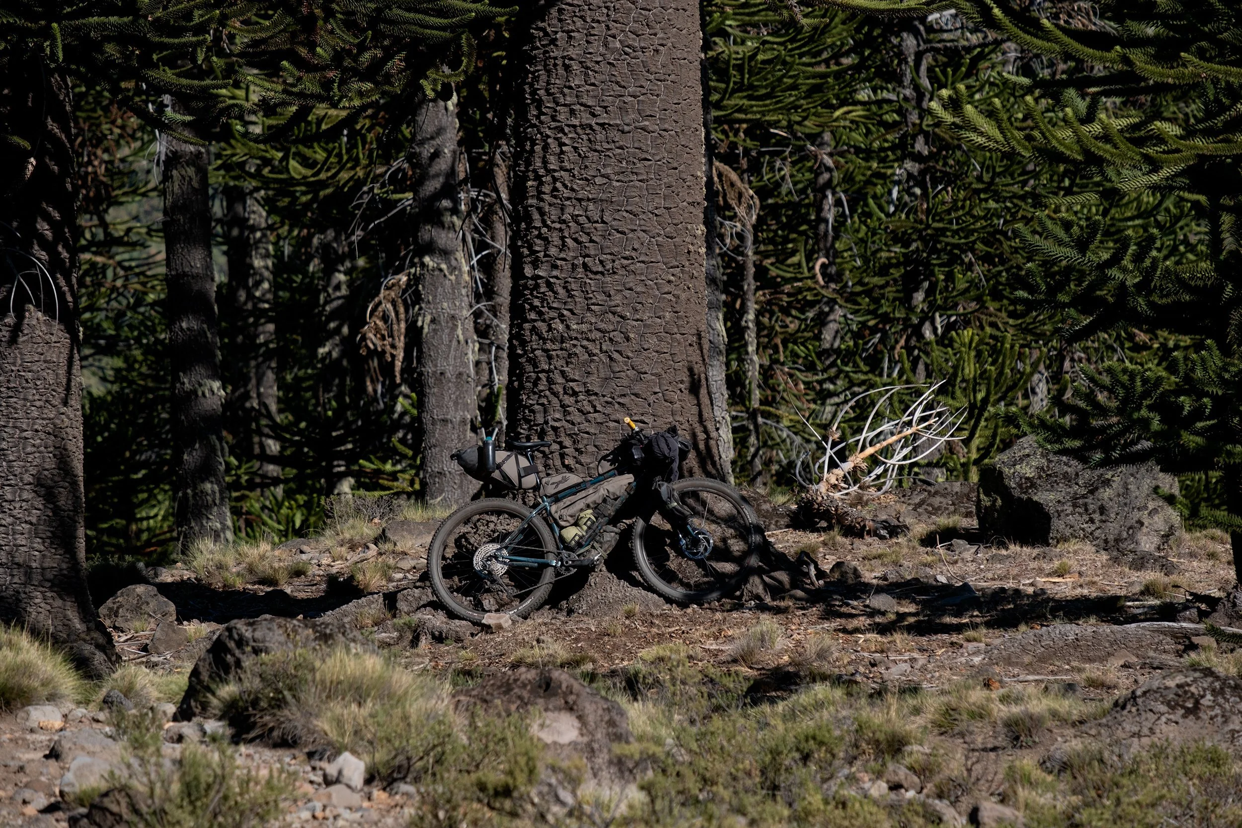
Cordillera de Fuego is a route that stretches across a unique strip of land nestled between the Pacific Ocean and the Chilean Andes, following the eastern edge of the Ring of Fire. This 500 km ruote explores some of the most breathtaking areas of the Bio-Bio and Araucanía regions, traveling through prehistoric-look landscapes dotted with towering snow-capped volcanoes and home to one of the world’s most famous living fossils, the Araucaria Aurucana tree.
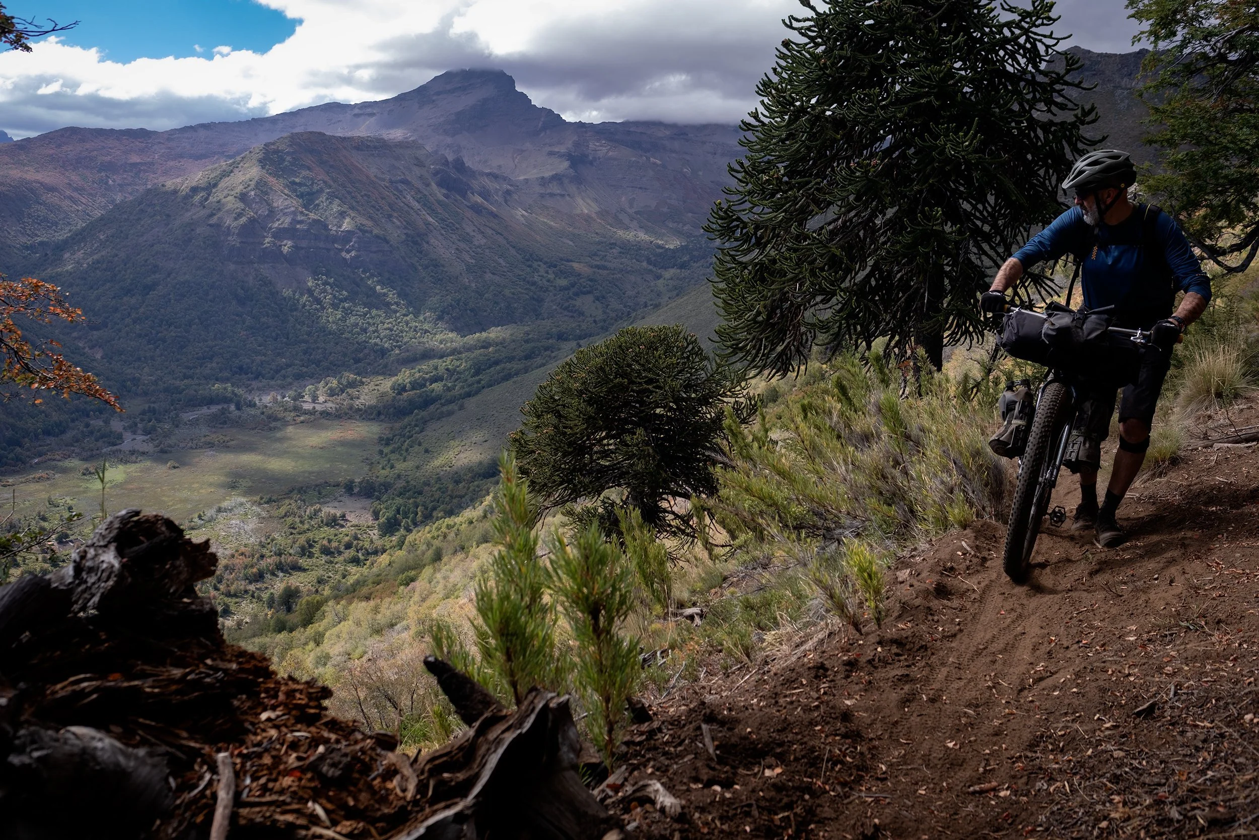
If there is a place in the world that could resemble Earth during the Mesozoic era, inhabited by enormous living fossils and dominated by massive volcano cones perpetually covered in snow, it is the central area of Chile, in the region closest to the Andes. The idea behind Cordillera de Fuego is to explore this area, which includes the regions of Bio-Bio, Araucanía, and the northern part of the Los Rios region, a vast area bordered to the east by the Andes mountain range and to the west by one of the areas with the highest concentration of volcanoes in the world. Cordillera de Fuego starts from the small town of Antuco and ends 500 km further south in Coñaripe, located on the shores of Lake Calafquen, winding between twelve of the most imposing volcanoes in Chile: Volcan Antuco, Sierra Velluda, Callaqui, Copahue, Tolhuaca, Lonquimay, Sierra Nevada, Llaima, Sollipulli, Villarica, Quetrupillan, and Volcan Lanin. Leaving the wide and very smooth gravel road that runs from Antuco to the Pichachèn Pass with Argentina, you turn south to enter the Laguna del Laja Park. After a few kilometers on fine volcanic sand, you find yourself riding on a singletrack that leads into the wildest and most remote part of the route, extending all the way to Laguna El Barco. It is essentially a network of trails used occasionally by the ‘huasos,’ typical Chilean cowboys, to cross the mountainous areas. One such trail is located after the tiny village of Trapa Trapa, crossing a valley of unique, wild beauty, carved by a river and surrounded by enormous Araucaria Araucana trees (Monkey Puzzle trees), which stand tall on the canyon's edges like sentinels. Sometimes, the singletrack climbs very steep slopes, where the effort is doubled due to the dense underbrush, but the effort is rewarded by the breathtaking views of landscapes shaped by plateaus, dominated by sceneries that seem to belong to ancient eras. Cordillera de Fuego explores an incredible land and touches some amazing protected areas, such as Parque Nacional Laguna del Laja, Reserva Nacional Malalcahuello-Nalcas, Conguillio National Park, Parque Nacional Villarica, and Reserva Nacional Hualalafquen. If you have extra time, you can choose to spend a few more days visiting these natural wonders. The route presents several river crossings, but they are usually easy to ford, except for the Rio Chaquilvin crossing, which is deeper than the others and requires more caution. After this crossing, you enter in an area, a sort of outpost of the “Wallmapu”, the ancestral land of the Mapuche-Pehuenche people where the comunidad of Los Guindos live. According to some locals, this could have been a “problematic” area, but we crossed it without any issues, under the curious eyes of the Mapuche farmers. Cordillera de Fuego continues through lava fields, perpetually snow-covered volcanic cones, and primordial lagoons dominated by the strong green-blue contrasts of the waters. The feeling of traveling in an era millions of years distant from our own is powerful and will accompany the bikepacker for much of the journey. Cordillera de Fuego ventures further south, where the landscape gradually softens, haciendas and small rural settlements become more frequent, and the possibility of a warm meal and a beer is no longer a mirage. The route ends in Conaripe, a small tourist town where you can relax on the beach of Lake Calafquen, with the magnificent view of the Villarica volcano in the background.


-
The feeling of traveling back in time through a prehistoric landscape, dominated by snow-capped volcanic cones and towering Araucaria trees—true living fossils from the Mesozoic era.
Marvel at the majestic scenery of Laguna del Laja, Conguillío, and Villarrica National Parks, as well as the Nalcas, Malalcahuello, China Muerta, and Hualalafquén National Reserves. If you have time, some of these parks offer short hikes that allow you to fully appreciate the hidden wonders of Chile’s protected areas.
Take in the breathtaking view before descending toward Laguna El Barco, nestled in a one-of-a-kind natural amphitheater.
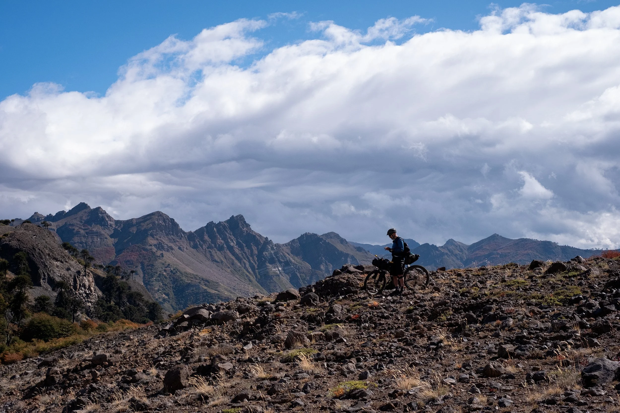
Enjoy incredible panoramas featuring the snow-covered peaks of 12 of Chile’s most stunning volcanoes: Antuco, Sierra Velluda, Callaqui, Copahue, Tolhuaca, Lonquimay, Sierra Nevada, Llaima, Sollipulli, Villarrica, Quetrupillán, and Lanín. The first 200 km of the Cordillera de Fuego are a dream for those who love exploring remote and wild landscapes.
Visiting the Monument of the Tragedia de Antuco, which honors a non-commissioned officer and 44 conscripts who perished during a military exercise on May 18, 2005, amid heavy snowfall and -35°C (-31°F) temperatures on the slopes of the Antuco volcano.
With some luck, you might spot the pudu, the world's smallest deer, standing 40 cm (16 in) tall and weighing around 10 kg (22 lbs).
-
Bikes: We rode Kona Unit X equipped with rigid forks and 2.6” Vittoria Mezcal tires, featuring excellent traction and low rolling resistance. This setup provided stability and control on technical, steep, and rugged sections, while also ensuring efficiency on gravel roads and paved stretches by simply adjusting tire pressure.
This route is best tackled during the dry season, between November and March. We rode it in early April, as we couldn't do it earlier in 2022 due to the COVID lockdown. The weather conditions were pretty good, except for a heavy storm that caught us in the highlands before reaching Laguna El Barco. However, this allowed us to experience these places with the most beautiful autumn colors.
Cordillera de Fuego often exceeds 1900 meters in altitude, which can mean that, under certain weather conditions, you may be forced to continue on snow-covered terrain, as we experienced in early April near the Lonquimay volcano, in the Malalcahuello-Nalcas National Park.
Beyond Rio Chaquilvin, you enter a region that serves as a kind of frontier to Wallmapu, the ancestral territory of the Mapuche-Pehuenche people, where the Los Guindos community resides. Some locals suggested this area might be “challenging,” but we passed through without any trouble—observed with curiosity by the Mapuche farmers.
This trip is a great opportunity to brush up on your Spanish, as very few people speak English—including the staff we encountered at the airports.
Cordillera de Fuego runs through the amazing Conguillio National Park. The entrance fee to is 3,700 CLP (3.60 euros - 3.70 $) per person.
-
Wild camping is possibile along most of the route. In some areas, it can be difficult to wild camp due to many fenced-off private properties, but there are some campgrounds and ‘cabanas’ where you can choose to spend the night and take an hot shower.
-
Water is available throughout the route but must be filtered.
There are no food supply options for the first 200 km.
You can restock at grocery stores and markets in Antuco, Malalcahuello, Manzanar, Melipeuco, Reigolil, and Curarrehue.
-
Before reaching the small Mapuche settlement of Trapa Trapa (km 78), you'll face a particularly challenging 7 km section. The 1,000 meters of descent are mostly tackled on foot, following a very rough and uneven trail.
At km 100, a narrow, steep trail climbs 450 meters through dense vegetation, requiring you to push your bike for about 3 km. But once you reach the top, the breathtaking view of the valley makes it all worthwhile.
At km 350, after descending a very steep section, you’ll need to climb over a tall wooden gate to continue. If you're riding with a partner, it’ll be much easier.
At km 360, you’ll cross private land. The owner was very kind to us and mentioned that cyclists, hikers, and horseback riders are allowed to pass through.
The route includes multiple river crossings, most of which are simple to wade through. However, the Rio Chaquilvin crossing is deeper than the others and demands extra attention.
-
For more information and regulations on national parks, visit: https://www.conaf.cl/
From Concepcion (where the international airport is located), you can take a bus or a private taxi transfer to reach the starting point of the route in Antuco, as well as to return from Conaripe, where the route ends.
ROUTE DIFFICULTY: 7,5
This route has been given a difficulty rating of 7.5, based on an average between the first 200 km—which are more challenging due to their truly remote and wild nature—and the rest of the route, which is less demanding. In the first section, the terrain can be extremely tough, with stretches of sand or loose rocks that make it difficult even to follow the trail. As the route ventures deeper into the mountains, you'll encounter steep climbs and technical descents that can be hard to ride, even while pushing your bike. It’s incredibly rare to see anyone in these areas, except for the occasional huaso on horseback. At the highest points of the route, you may find yourself pushing your bike through snow—just like we did in early April when we passed near Lonquimay Volcano at around 1,900 meters in Malalcahuello National Park.
!! WARNING !!
We STRONGLY DISCOURAGE anyone without the necessary skills and mindset for extreme environments—such as mountains, deserts, river crossings, and remote water and food resupply—to follow the routes on this site. These routes are designed primarily for EXPLORATION and are not intended for traditional bike touring. If your experience is solely in cycling, without a solid background in outdoor survival and self-sufficiency, you are STRONGLY ADVISED AGAINST attempting these routes. They demand an adventurous spirit, adaptability, and the ability to handle unforeseen challenges in the field. Proceed entirely at your own risk. While every effort has been made to provide accurate GPS tracks and route information, we cannot guarantee their reliability over time due to factors such as land access changes, property rights restrictions, and the closure of supply points. All the information provided on this site is more than sufficient to ride these routes. Please do not email us requesting additional info about the routes, as you will not receive a response - sorry for that. Further information for every route can be found in the comments on Bikepacking.com (click on “Check it on Bikepacking.com” button). The route creators are in no way responsible for personal injuries, damage to property, or any other incidents that may occur while riding or following these routes.