


Bikepacking Sibillini
Marche - ITALY
HIGH POINT
1820 m
DIFFICULTY (1/10)
5
DISTANCE
158 Km
DAYS
3/4
% SINGLETRACK
10%
% UNPAVED
68%
TOTAL ASCENT
4822 m
% RIDEABLE TIME
99%
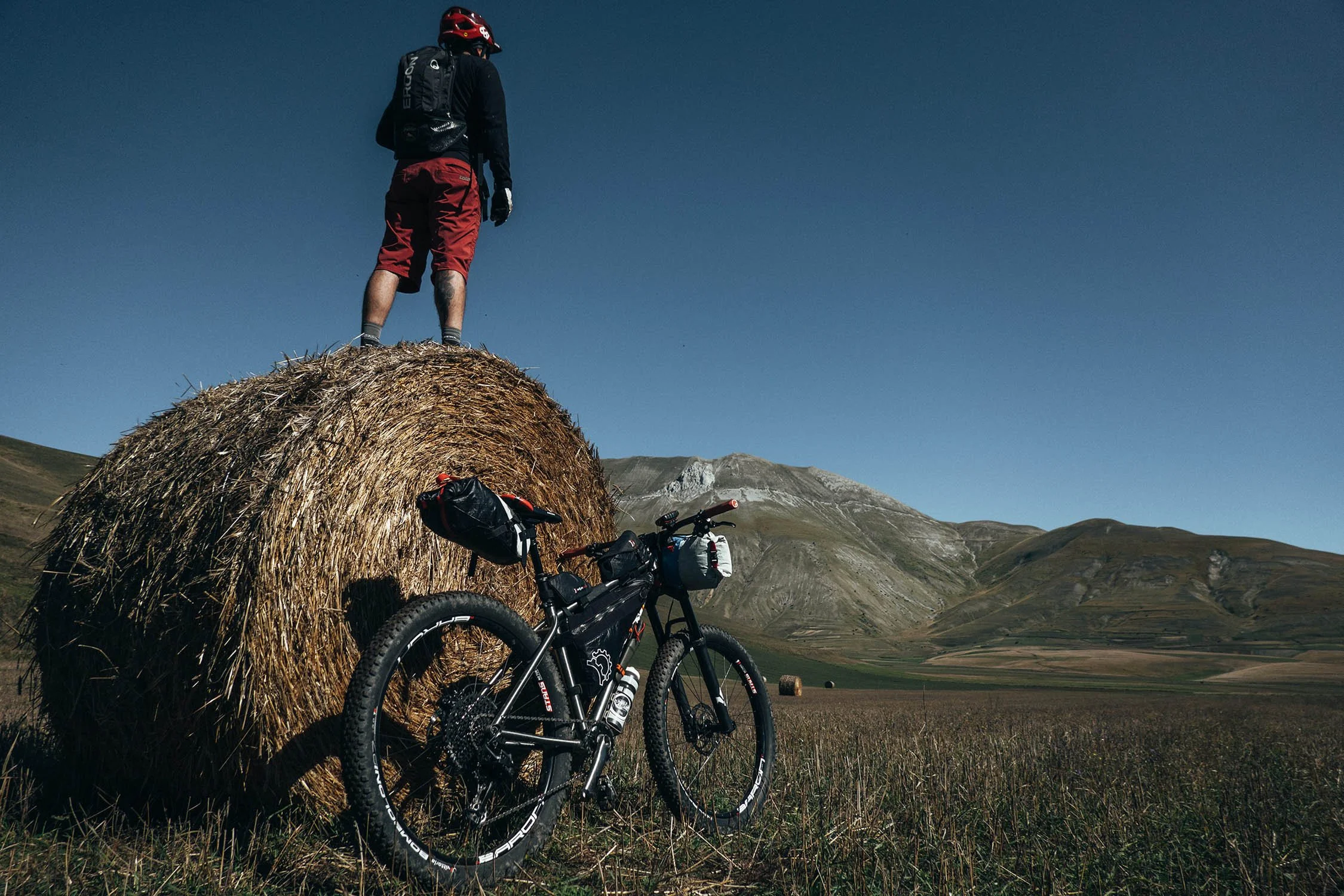
Nestled in the heart of Italy’s Marche region, Monti Sibillini National Park offers a spectacular 3-4 day bikepacking loop around one of the most stunning mountain massifs on the Italian peninsula. This route follows a mix of gravel roads and singletrack trails, winding through enchanting landscapes steeped in myths and medieval legends.
For centuries, the Sibillini Mountains have captivated travelers and explorers, their rugged peaks inspiring both awe and mystery. Since the 15th century, these mountains have fueled imaginations across Europe, their legends swirling with tales of sorcery and adventure. One of the most famous myths tells of an ancient oracle, Sibilla, who was said to have lived atop one of these peaks. Even today, these mountains hold an undeniable magic for those who journey through them.
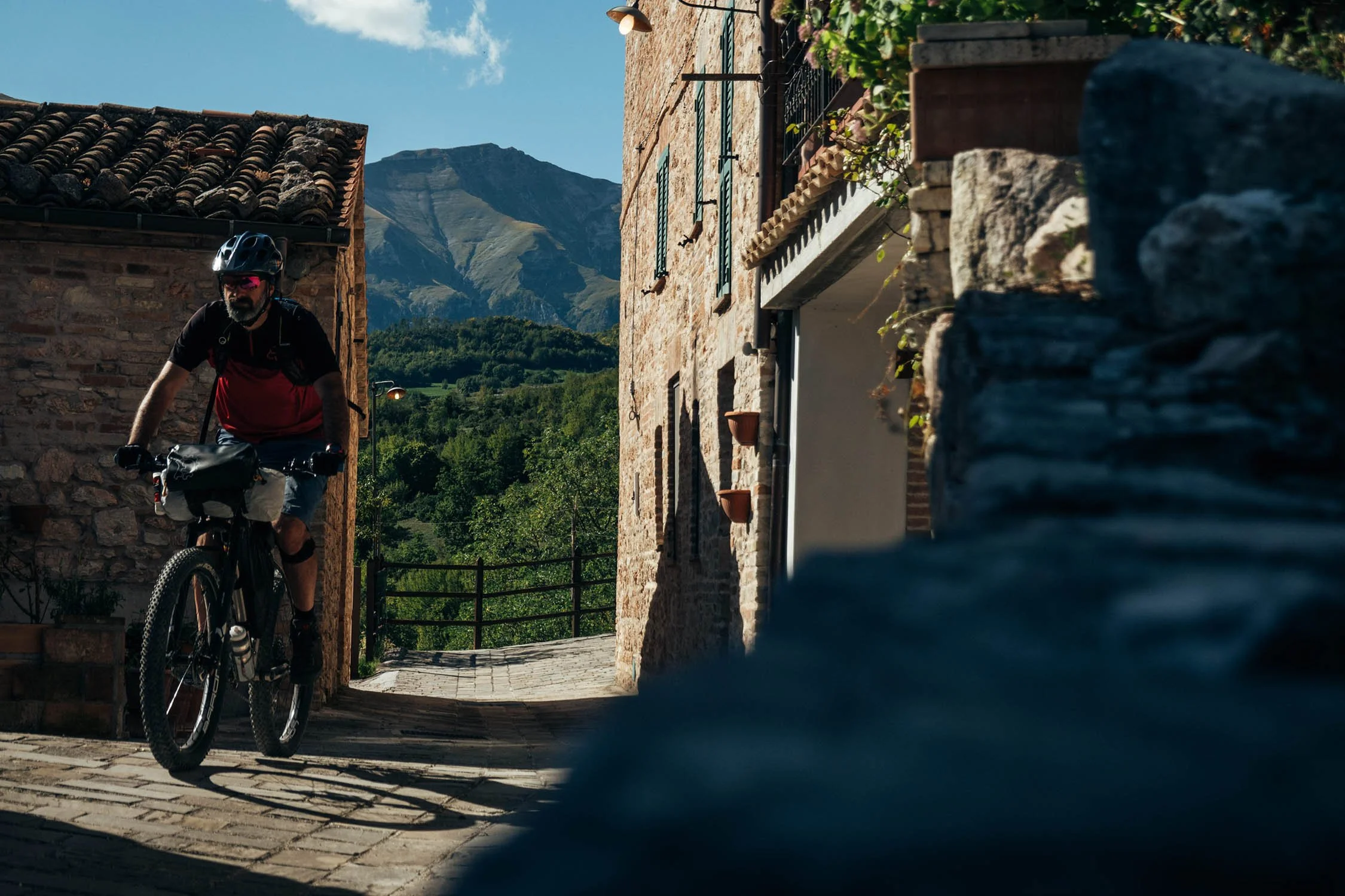
Starting from the historic village of Visso, the Sibillini bikepacking loop offers a remarkable variety of landscapes in just 158 kilometers. This clockwise route traverses an ever-changing terrain, from high mountain valleys to crystal-clear lakes, panoramic ridgelines, and wild, untamed meadows. It begins by climbing through Val di Panico, a dramatic valley that hugs the jagged, “Dolomitic” cliffs of Monte Bove. Further along, the shimmering blue waters of Lake Fiastra invite riders to pause, take a swim, and indulge in the flavors of Italian cuisine.
On the eastern side of the route, the Prati di Ragnolo plateau unfolds like a vast, green carpet, offering breathtaking views. From here, you can gaze westward over the wild valleys of Ambro and Infernaccio, while the rolling hills of Marche and the Adriatic Sea stretch to the east.
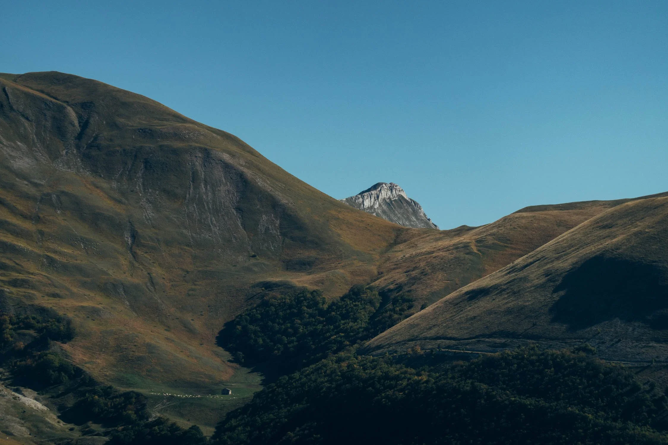
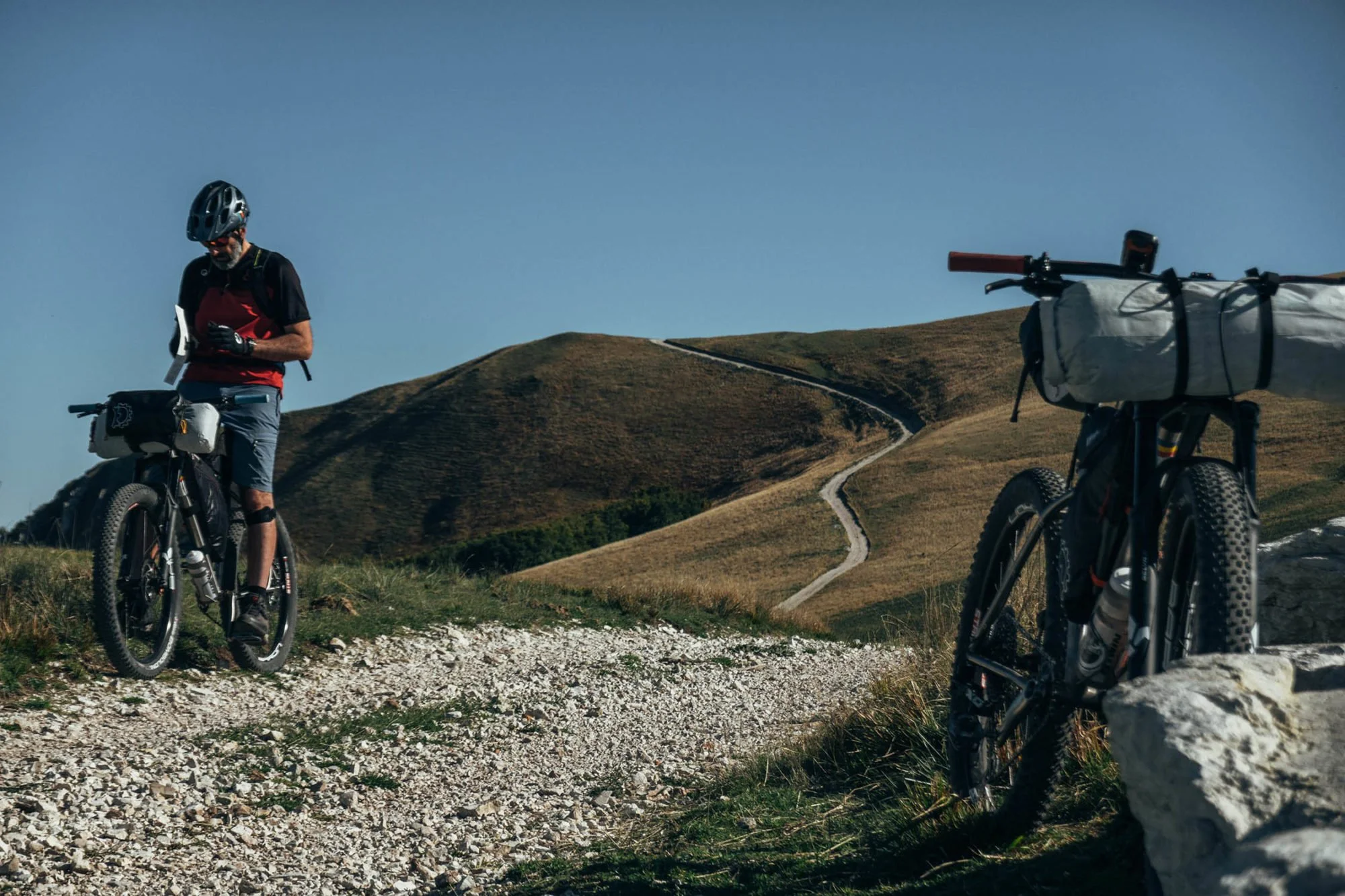
The route is mostly rideable, with even the singletrack sections remaining relatively non-technical. The only real reason to stop pedaling? The views. One of the most awe-inspiring panoramas comes at Forca di Presta, a mountain pass in the southern part of the loop. From here, you’ll overlook the sprawling Piana di Castelluccio and the towering silhouette of Monti della Laga. The journey continues across the Castelluccio plateau, rolling through Pian Piccolo and Pian Grande on a network of grassy trails and doubletrack. This leads to the picturesque town of Castelluccio, perched in the shadow of Monte Vettore—the highest peak in the Sibillini range at 2.476 meters. If you time your ride between late May and early July, you’ll witness the plateau bursting into color as wildflowers bloom in an unforgettable display.
Reaching the loop’s highest point at 1,820 meters, the route then descends back to Visso (600m) via a thrilling series of winding gravel paths and doubletrack.
Bikepacking through the Sibillini Mountains is more than just an adventure—it’s an almost mystical experience. As you pedal through these surreal landscapes, it’s easy to lose yourself in the timeless beauty of the mountains. Remote valleys and pyramid-shaped peaks create an otherworldly atmosphere, where light and shadow dance across the vast meadows. This is a place where the past and present merge, where every turn in the trail reveals a new wonder, and where the magic of the Sibillini never fades.
Best New Routes (Weekend)


-
The spectacular views from Fiastra Lake and the trail that runs along the eastern shore.
The Sanctuary of Macereto which stands on an isolated plateau in the western side of the route. It’s a religious complex and one of the greatest expressions of Renaissance architecture of the 16th century in the Marche region. It can be reached with a detour of 1.5km from the route, but it’s definitely worth it!
Epic view of the Adriatic sea along the Prati di Ragnolo near Pizzo Meta in the north-eastern side of the route.
From the Forca di Presta pass. At 1,550m, you can enjoy the spectacular views of the Piana di Castelluccio, and in the opposite direction, the peaks of Monti della Laga.
Epic view of Monte Vettore, the highest peak in the Sibillini mountains (2476m), whose top stands out over the Castelluccio plains.
Fiorita di Castelluccio, between late May and early July you can admire the array of wildflowers that bloom on the plateau, bursting with colors ranging from yellow ochre to red, from violet to white. The species of flowers that paint the Piana di Castelluccio include lentils, gentianella, buttercups, poppies, narcissuses, violets, asphodels, Eugeniae violet, clovers, oxalis, and many more.
The Italian-shaped forest near the plain of Castelluccio where conifers were planted in 1961 in memory of the nation’s first centenary of unity.
-
The Monti Sibillini area was hit hard by an earthquake in 2016. It is therefore recommended not to enter the “red zones” of the historic centers of Visso, Ussita, and Castelluccio villages.
Best bike: a hardtail MTB or fully rigid plus bike is recommended for this mixed-terrain loop. Even a gravel bike would work, especially with wide and tough tires (700x45mm or 650b x 2.1″) due to some rough sections.
When to go: the ideal riding season is between mid-May and mid-October. In winter some sections of the route are not passable due to the snow.
The route passes through grazing areas where there could be sheepdogs. If they chase you, the best way to proceed is to get off the bike and continue on foot, placing the bike between you and the dog.
-
Wild camping is permitted along the route, except for the Castelluccio plateau (from Km120 to 129 /from mi 74.5 to 80). As always, #leavenotrace.
Just before the no camping zone, there’s an excellent location to pitch a tent or bivy. It is close to the Belvedere mountain hut and offers a spectacular view of the Monti della Laga.
Campfires are banned in the Sibillini National Park.
There are two campsites along the route. ‘B-Site Camp’ on the banks of Fiastra lake and ‘Camping Sibilla’ in Montefortino (both noted on the GPX).
Lodging is possible in some villages along the route or nearby. More info here.
-
Drinking water is never an issue. There is plenty of water fountains along the route. The only stretch where there is no water supply is between Castelluccio and Visso (about 25km).
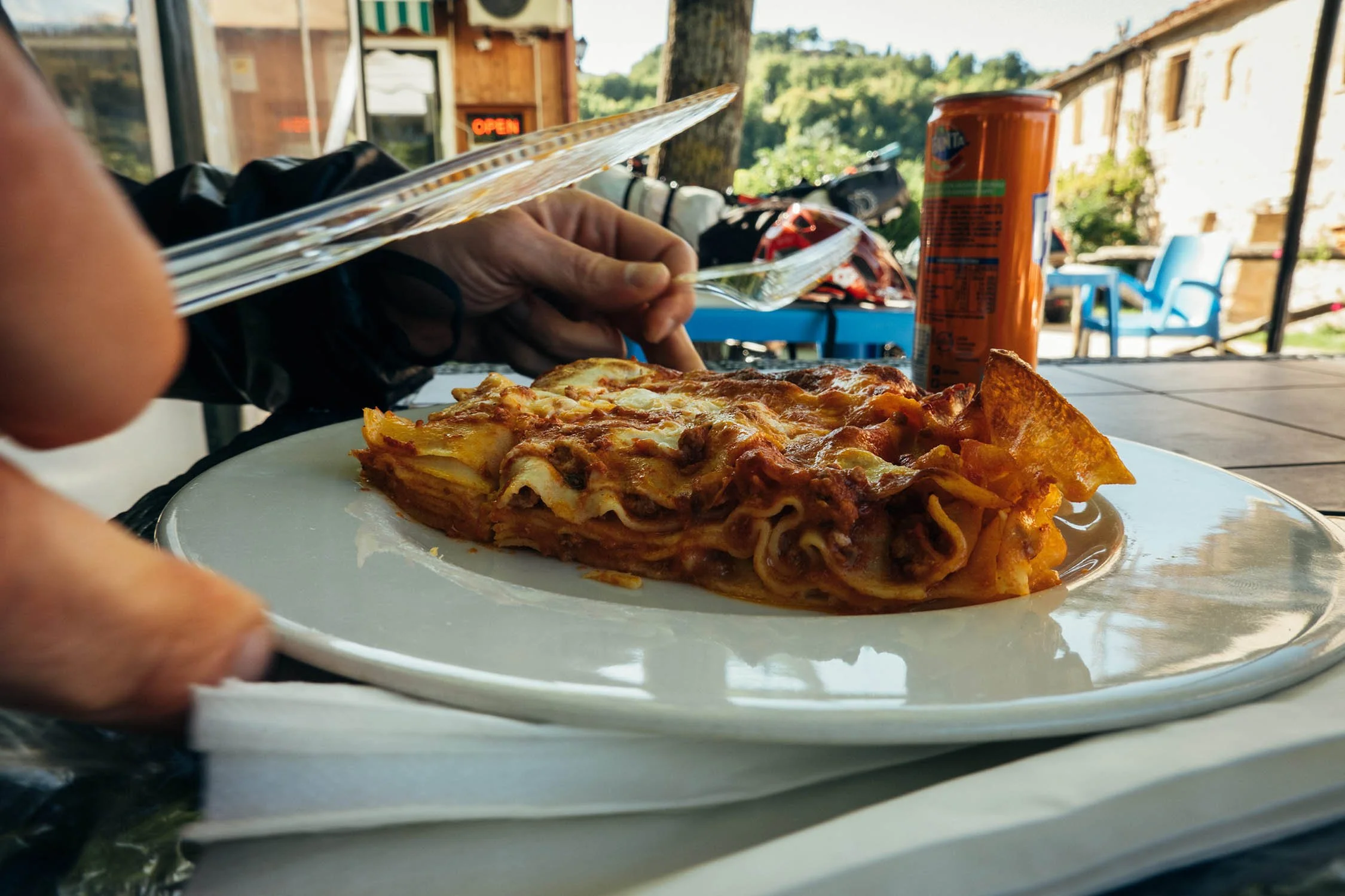
On the Fiastra lake there is “La Spiaggetta” where you can eat, and if necessary, repair your bike thanks to a bike repair station. In front of the restaurant there is also a small beach where you can relax.
A “must-stop” is at La Capanna in Pintura where you can enjoy typical cuisine, take sandwiches, or even sleep. There is also a bike repair station available for riders.
Food can be bought from grocers in Visso and Fiastra (noted on the GPX).
-
Additional Resources
Sibillinibikepacking.it the official webpage for the Sibillini bikepacking event.
Sibillini.net is the official webpage for the Sibillini National Park.
Route Development
We originally rode in Sibillini National Park in 2016 when we pedaled the G.A.S. (Grande Anello dei Sibillini), one of the most beautiful hiking paths in central Italy. Two months later an earthquake struck the Sibillini area and the access to many of the sections we rode were closed for safety reasons. Three years later many of those areas have been reopened. This route was based on a specially designed version of the G.A.S. and is the result of the joint efforts of locals Ivano D’Orazio, Fabrizio Castelli, and Loretta Piergentili. We’d like to thank them for inviting us back to the Sibillini Mountains. Their Association Marche Bikepacking organizes “Sibillini Bikepacking,” the first unsupported bikepacking event in the Sibillini National Park which will be held in May this year. Learn more at sibillinibikepacking.it.
!! WARNING !!
We STRONGLY DISCOURAGE anyone without the necessary skills and mindset for extreme environments—such as mountains, deserts, river crossings, and remote water and food resupply—to follow the routes on this site. These routes are designed primarily for EXPLORATION and are not intended for traditional bike touring. If your experience is solely in cycling, without a solid background in outdoor survival and self-sufficiency, you are STRONGLY ADVISED AGAINST attempting these routes. They demand an adventurous spirit, adaptability, and the ability to handle unforeseen challenges in the field. Proceed entirely at your own risk. While every effort has been made to provide accurate GPS tracks and route information, we cannot guarantee their reliability over time due to factors such as land access changes, property rights restrictions, and the closure of supply points. All the information provided on this site is more than sufficient to ride these routes. Please do not email us requesting additional info about the routes, as you will not receive a response - sorry for that. Further information for every route can be found in the comments on Bikepacking.com (click on “Check it on Bikepacking.com” button). The route creators are in no way responsible for personal injuries, damage to property, or any other incidents that may occur while riding or following these routes.